| dbo:abstract
|
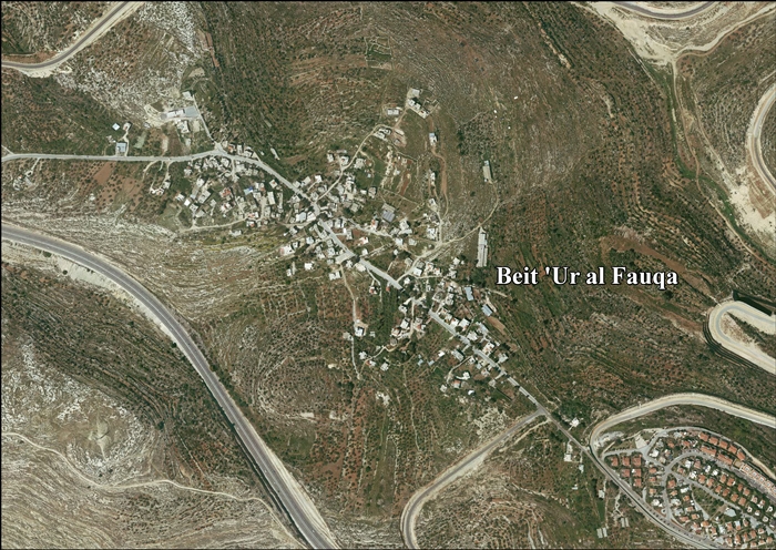
- بيت عور الفوقا هي قرية فلسطينية تقع في الضفة الغربية من أراض السلطة الفلسطينية. وتتبع محافظة رام الله والبيرة وقعت تحت الاحتلال الإسرائيلي في حرب 1967. تقع إلى الغرب من مدينة رام الله وتبعد عنها حوالي 12 كم، وترتفع عن سطح البحر حوالي 600م، وهذه القرية بناها الكنعانيون وسموها (بيت حرون العليا). تبلغ مساحة أراضيها 3818 دونماً، وتحيط بها أراضي قرى بيتونيا، بيت لقيا، بيت عور التحتا ودير ابزيع. وتعتبر القرية ذات موقع أثري يحتوي على جدران قديمة وبقايا صليبية وسراديب رومانية تحت الأرض وبركة وتقع في أراضيها خربة دير حسان، خربة الزيت وخربة حرفوش. قدر عدد سكانها عام 1922 حوالي 147 نسمة وفي عام 1945 (210) نسمة، وبعد عام 1967. بلغ العدد (298) نسمة، وفي عام 1987 أصبح 468 نسمة. بلغ عدد سكان القرية حسب التعداد العام للمنشآت والمساكن لعام 2007، (812) نسمة موزعين 400 إناث و412 ذكور. تنحدر من هذه القرية رشيدة طليب، أول عربية تدخل الكونغرس الأميركي ولدت لأب من بيت حنينا وأم من بيت عور الفوقا.[1] (ar)
- Beit Ur al-Fauqa (àrab: بيت عور الفوقا, Bayt ʿŪr al-Fawqā) és una vila palestina a la governació de Ramal·lah i al-Bireh, al centre de Cisjordània, situada 14 kilòmetres a l'est de Ramal·lah i a 3 kilòmetres al sud-est de Beit Ur al-Tahta, al llarg de la , el camí bíblic de Bethoron. Segons l'Oficina Central d'Estadístiques de Palestina (PCBS), tenia una població de 1.106 habitants el 2016. (ca)
- Beit Ur al-Fauqa (Arabic: بيت عور الفوقا) is a Palestinian village located in the Ramallah and al-Bireh Governorate of the State of Palestine, in the northern West Bank, 14 kilometers (8.7 mi) west of Ramallah and 3 kilometers (1.9 mi) southeast of Beit Ur al-Tahta. According to the Palestinian Central Bureau of Statistics, it had a population of 864 in the 2007 census. (en)
- Bajt Ur al-Fauka – wieś w Palestynie, w muhafazie Ramallah i Al-Bira. Według danych Palestyńskiego Centralnego Biura Statystycznego w 2016 roku miejscowość liczyła 1106 mieszkańców. (pl)
|
| dbo:country
| |
| dbo:elevation
| |
| dbo:governmentType
| |
| dbo:populationTotal
|
- 864 (xsd:nonNegativeInteger)
|
| dbo:subdivision
| |
| dbo:thumbnail
| |
| dbo:wikiPageExternalLink
| |
| dbo:wikiPageID
| |
| dbo:wikiPageLength
|
- 23359 (xsd:nonNegativeInteger)
|
| dbo:wikiPageRevisionID
| |
| dbo:wikiPageWikiLink
| |
| dbp:blankInfoSec
| |
| dbp:blankNameSec
| |
| dbp:elevationM
| |
| dbp:establishedTitle
| |
| dbp:governmentType
| |
| dbp:gridName
| |
| dbp:gridPosition
| |
| dbp:imageSkyline
|
- PikiWiki Israel 9676 matat look-out in bet-horon.jpg (en)
|
| dbp:name
| |
| dbp:populationAsOf
| |
| dbp:populationDensityKm
| |
| dbp:populationTotal
| |
| dbp:pushpinMap
| |
| dbp:pushpinMapCaption
|
- Location of Beit Ur al-Fauqa within Palestine (en)
|
| dbp:subdivisionName
| |
| dbp:subdivisionType
| |
| dbp:translitLang
| |
| dbp:translitLang1Info
|
- Bayt ‘Ūr al-Fawqā (en)
- Bayt ’Ur al-Fauqa (en)
- Beit ’Ur al-Foqa (en)
- بيت عور الفوقا (en)
|
| dbp:translitLang1Type
| |
| dbp:type
| |
| dbp:unitPref
| |
| dbp:wikiPageUsesTemplate
| |
| dcterms:subject
| |
| gold:hypernym
| |
| schema:sameAs
| |
| georss:point
|
- 31.885833333333334 35.11416666666667
|
| rdf:type
| |
| rdfs:comment
|
- Beit Ur al-Fauqa (àrab: بيت عور الفوقا, Bayt ʿŪr al-Fawqā) és una vila palestina a la governació de Ramal·lah i al-Bireh, al centre de Cisjordània, situada 14 kilòmetres a l'est de Ramal·lah i a 3 kilòmetres al sud-est de Beit Ur al-Tahta, al llarg de la , el camí bíblic de Bethoron. Segons l'Oficina Central d'Estadístiques de Palestina (PCBS), tenia una població de 1.106 habitants el 2016. (ca)
- Beit Ur al-Fauqa (Arabic: بيت عور الفوقا) is a Palestinian village located in the Ramallah and al-Bireh Governorate of the State of Palestine, in the northern West Bank, 14 kilometers (8.7 mi) west of Ramallah and 3 kilometers (1.9 mi) southeast of Beit Ur al-Tahta. According to the Palestinian Central Bureau of Statistics, it had a population of 864 in the 2007 census. (en)
- Bajt Ur al-Fauka – wieś w Palestynie, w muhafazie Ramallah i Al-Bira. Według danych Palestyńskiego Centralnego Biura Statystycznego w 2016 roku miejscowość liczyła 1106 mieszkańców. (pl)
- بيت عور الفوقا هي قرية فلسطينية تقع في الضفة الغربية من أراض السلطة الفلسطينية. وتتبع محافظة رام الله والبيرة وقعت تحت الاحتلال الإسرائيلي في حرب 1967. تقع إلى الغرب من مدينة رام الله وتبعد عنها حوالي 12 كم، وترتفع عن سطح البحر حوالي 600م، وهذه القرية بناها الكنعانيون وسموها (بيت حرون العليا). تبلغ مساحة أراضيها 3818 دونماً، وتحيط بها أراضي قرى بيتونيا، بيت لقيا، بيت عور التحتا ودير ابزيع. وتعتبر القرية ذات موقع أثري يحتوي على جدران قديمة وبقايا صليبية وسراديب رومانية تحت الأرض وبركة وتقع في أراضيها خربة دير حسان، خربة الزيت وخربة حرفوش. (ar)
|
| rdfs:label
|
- Beit Ur al-Fauqa (en)
- بيت عور الفوقا (ar)
- Beit Ur al-Fauqa (ca)
- Bajt Ur al-Fauka (pl)
|
| owl:sameAs
| |
| geo:geometry
|
- POINT(35.114166259766 31.885833740234)
|
| geo:lat
| |
| geo:long
| |
| prov:wasDerivedFrom
| |
| foaf:depiction
| |
| foaf:isPrimaryTopicOf
| |
| foaf:name
| |
| is dbo:wikiPageRedirects
of | |
| is dbo:wikiPageWikiLink
of | |
| is foaf:primaryTopic
of | |


