| dbo:abstract
|
- في صيف عام 1965، بينت الصور الأولى القريبة من سطح المريخ صحراء مليئةً بالفوهات دون أي علامات على وجود المياه. ومع ذلك، ومع تصوير أجزاء أخرى من الكوكب باستخدام آلات تصوير أكثر تطورًا علي مر العقود، ظهرت بعض الأدلة التي تدعم وجود وديان لأنهار سابقة، وبحيرات وثلوج موجودة في الأنهار الجليدية على سطح الكوكب. واكتشف العلماء أن المناخ المريخي يمر بتغيرات كبيرة على مدار الزمن الجيولوجي بسبب عدم استقرار محوره بقمر ضخم مثل محور كوكب الأرض. ويعتقد بعض الباحثين أيضًا أنه ربما كانت المياه السائلة موجودةً على سطح المريخ في فترات من الماضي بسبب الآثار الحرارية الجوفية، والتركيب الكيميائي، والاصطدامات النيزكية. وتصف هذه المقالة بعض المناطق التي كان من الممكن أن تضم بحيرات ضخمةً في الماضي. (ar)
- In summer 1965, the first close-up images from Mars showed a cratered desert with no signs of water. However, over the decades, as more parts of the planet were imaged with better cameras on more sophisticated satellites, Mars showed evidence of past river valleys, lakes and present ice in glaciers and in the ground. It was discovered that the climate of Mars displays huge changes over geologic time because its axis is not stabilized by a large moon, as Earth's is. Also, some researchers maintain that surface liquid water could have existed for periods of time due to geothermal effects, chemical composition or asteroid impacts. This article describes some of the places that could have held large lakes. (en)
- Ar an 29ú lá de Mhí Iúil, 2005, tháinig an tuairisc ón mBBC go rabhthas tar éis "loch leacoighir" infheicthe a shonrú i gcráitéar i réigiún an phoil thuaidh ar Mhars. Na grianghrafanna den chráitéar a tógadh le ceamara steiréascópach ardtaifigh a bhí á iompar ag an spásárthach Mars Express de chuid údarás spás na hEorpa, taispeánann siad go soiléir leac leathan oighir i dtóin cráitéir gan ainm agus é suite ar an machaire timpeall ar an bpol thuaidh, is é sin, . Is é an suíomh cruinn atá ag an gcráitéar ná seachtó céim go leith den leithne thuaisceartach agus céad agus trí chéim den fhad oirthearach. Tá an cráitéar féin tríocha cúig chiliméadar ar trastomhas agus dhá chiliméadar, a bheag nó a mhór, ar doimhneacht. De réir an chéad aithne, tá droim na leice oighir thart ar dhá chéad méadar níos airde ná bun an chráitéir féin. Deir saineolaithe an ESA gur gaineamh is cúis leis an gcuid is mó den difríocht airde seo, agus cuid mhaith den ghaineamh sin le feiceáil, fiú. Cé gur fearr leis na heolaithe gan an focal sin loch a úsáid agus iad ag tagairt don leac oighir áirithe seo, ábhar suntais is ea é i gcónaí teacht ar a leithéid de phaiste d'oighear uisce, agus é le feiceáil ó thús go deireadh na bliana. Is iomaí áit ar Mhars inar thángthas trasna ar shil-leaganacha uisce agus ar shraitheanna oighir. (ga)
- 1965年夏天,来自火星的首幅特写照片显示了一片没有水迹象的不毛之地。然而,数十年来,随着更先进探测器使用更好的相机对该行星更多地区的成像,火星显示了过去的河谷、湖泊以及冰川和地表中存在水冰的证据。人们发现,火星气候在整个地质时期表现出巨大的变化,因为它的自转轴并不像地球那样被一颗大卫星所稳定。此外,部分研究人员认为,由于地热效应、化学成分或小行星的撞击,液态水在火星地表上可能曾存在过一段时间。本篇描述了一些可能出现过大型湖泊的地方。 (zh)
|
| dbo:thumbnail
| |
| dbo:wikiPageExternalLink
| |
| dbo:wikiPageID
| |
| dbo:wikiPageLength
|
- 111139 (xsd:nonNegativeInteger)
|
| dbo:wikiPageRevisionID
| |
| dbo:wikiPageWikiLink
| |
| dbp:align
| |
| dbp:caption
|
- Clay mineral structure of mudstone. (en)
- Hole () drilled into "John Klein" mudstone. (en)
- Spectral Analysis (SAM) of "Cumberland" mudstone. (en)
- Columbus crater based on THEMIS day-time image (en)
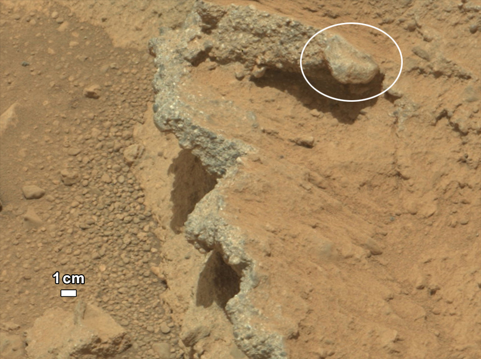
- "Link" rock outcrop on Mars – compared with a terrestrial fluvial conglomerate – suggesting water "vigorously" flowing in a stream. (en)
- Map of Coprates quadrangle from Mars Orbiter Laser Altimeter data. The highest elevations are red and the lowest are blue. (en)
- Crater Holden based on THEMIS day-time image (en)
- "Hottah" rock outcrop on Mars – an ancient streambed viewed by Curiosity . (en)
- Jezero crater and region (en)
- Uzboi Vallis based on THEMIS day-time image (en)
- Peace Vallis and related alluvial fan near the Curiosity landing ellipse and landing site . (en)
|
| dbp:coordinateTitle
| |
| dbp:diameter
| |
| dbp:direction
|
- horizontal (en)
- vertical (en)
|
| dbp:eponym
|
- Christopher Columbus, Italian explorer (en)
- Jezero, meaning "lake" in Slavic languages (en)
|
| dbp:footer
|
- The Curiosity rover examines mudstone near Yellowknife Bay on Mars . (en)
- Curiosity on the way to Glenelg . (en)
|
| dbp:footerAlign
| |
| dbp:globe
| |
| dbp:header
|
- Evidence of water on Mars in Gale crater (en)
|
| dbp:image
|
- PIA16189 fig1-Curiosity Rover-Rock Outcrops-Mars and Earth.jpg (en)
- PIA17598-MarsCuriosityRover-Mudstone-ClayMineralStructure-20131209.jpg (en)
- PIA16158-Mars Curiosity Rover-Water-AlluvialFan.jpg (en)
- PIA17594-MarsCuriosityRover-JohKleinMudstoneDrillHole-20130510.jpg (en)
- PIA16156-Mars Curiosity Rover-Water-AncientStreambed.jpg (en)
- PIA17599-MarsCuriosityRover-CumberlandRock-Spectra-20121209.jpg (en)
|
| dbp:length
| |
| dbp:name
|
- Coprates quadrangle (en)
- Uzboi Vallis (en)
|
| dbp:naming
|
- Dry riverbed (en)
- in Russia. (en)
|
| dbp:title
|
- Holden (en)
- Columbus Crater (en)
- Jezero crater (en)
|
| dbp:titlecolor
| |
| dbp:width
|
- 200 (xsd:integer)
- 250 (xsd:integer)
|
| dbp:wikiPageUsesTemplate
| |
| dcterms:subject
| |
| georss:point
| |
| rdf:type
| |
| rdfs:comment
|
- في صيف عام 1965، بينت الصور الأولى القريبة من سطح المريخ صحراء مليئةً بالفوهات دون أي علامات على وجود المياه. ومع ذلك، ومع تصوير أجزاء أخرى من الكوكب باستخدام آلات تصوير أكثر تطورًا علي مر العقود، ظهرت بعض الأدلة التي تدعم وجود وديان لأنهار سابقة، وبحيرات وثلوج موجودة في الأنهار الجليدية على سطح الكوكب. واكتشف العلماء أن المناخ المريخي يمر بتغيرات كبيرة على مدار الزمن الجيولوجي بسبب عدم استقرار محوره بقمر ضخم مثل محور كوكب الأرض. ويعتقد بعض الباحثين أيضًا أنه ربما كانت المياه السائلة موجودةً على سطح المريخ في فترات من الماضي بسبب الآثار الحرارية الجوفية، والتركيب الكيميائي، والاصطدامات النيزكية. وتصف هذه المقالة بعض المناطق التي كان من الممكن أن تضم بحيرات ضخمةً في الماضي. (ar)
- In summer 1965, the first close-up images from Mars showed a cratered desert with no signs of water. However, over the decades, as more parts of the planet were imaged with better cameras on more sophisticated satellites, Mars showed evidence of past river valleys, lakes and present ice in glaciers and in the ground. It was discovered that the climate of Mars displays huge changes over geologic time because its axis is not stabilized by a large moon, as Earth's is. Also, some researchers maintain that surface liquid water could have existed for periods of time due to geothermal effects, chemical composition or asteroid impacts. This article describes some of the places that could have held large lakes. (en)
- 1965年夏天,来自火星的首幅特写照片显示了一片没有水迹象的不毛之地。然而,数十年来,随着更先进探测器使用更好的相机对该行星更多地区的成像,火星显示了过去的河谷、湖泊以及冰川和地表中存在水冰的证据。人们发现,火星气候在整个地质时期表现出巨大的变化,因为它的自转轴并不像地球那样被一颗大卫星所稳定。此外,部分研究人员认为,由于地热效应、化学成分或小行星的撞击,液态水在火星地表上可能曾存在过一段时间。本篇描述了一些可能出现过大型湖泊的地方。 (zh)
- Ar an 29ú lá de Mhí Iúil, 2005, tháinig an tuairisc ón mBBC go rabhthas tar éis "loch leacoighir" infheicthe a shonrú i gcráitéar i réigiún an phoil thuaidh ar Mhars. Na grianghrafanna den chráitéar a tógadh le ceamara steiréascópach ardtaifigh a bhí á iompar ag an spásárthach Mars Express de chuid údarás spás na hEorpa, taispeánann siad go soiléir leac leathan oighir i dtóin cráitéir gan ainm agus é suite ar an machaire timpeall ar an bpol thuaidh, is é sin, . Is é an suíomh cruinn atá ag an gcráitéar ná seachtó céim go leith den leithne thuaisceartach agus céad agus trí chéim den fhad oirthearach. Tá an cráitéar féin tríocha cúig chiliméadar ar trastomhas agus dhá chiliméadar, a bheag nó a mhór, ar doimhneacht. (ga)
|
| rdfs:label
|
- بحيرات المريخ (ar)
- Leaca oighir Mharsa (ga)
- Lakes on Mars (en)
- 火星湖泊 (zh)
|
| rdfs:seeAlso
| |
| owl:sameAs
| |
| geo:geometry
| |
| geo:lat
| |
| geo:long
| |
| prov:wasDerivedFrom
| |
| foaf:depiction
| |
| foaf:isPrimaryTopicOf
| |
| is dbo:wikiPageRedirects
of | |
| is dbo:wikiPageWikiLink
of | |
| is rdfs:seeAlso
of | |
| is foaf:primaryTopic
of | |


