| dbo:abstract
|
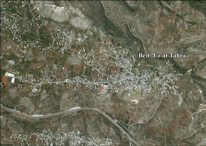
- Beit Ur al-Tahta (àrab: بيت عور التحتى, Bayt ʿŪr at-Taḥtà, ‘Casa baixa d'Ur’) és una vila palestina en la governació de Ramal·lah i al-Bireh, al centre de Cisjordània. Segons l'Oficina Central d'Estadístiques de Palestina (PCBS), tenia una població de 5.595 habitants en 2016. Està situada en el lloc de la bíblica Bethoron, en un turó al costat de Beit Ur al-Fauqa. Limita amb Kharbatha al-Misbah al sud, Beit Ur al-Fauqa al sud-est, Beitunia a l'est, Ein 'Arik i Deir Ibzi al nord-est, Kafr Ni'ma al nord, Bil'in al nord-oest, Saffa a l'oest i Beit Sira al sud-oest. (ca)
- بيت عور التحتا، قرية فلسطينية تقع في الجهة الغربية من مدينة رام الله، وتميل نحو الجنوب، وتبعد عنها حوالي 16 كم وتتبع إدارياً لمحافظة رام الله والبيرة وتقع على طريق رئيسي يربط ما بين القدس وتل أبيب، وترتفع 380م عن سطح البحر. كان اسمها في عهد سليمان بيت حورون وهي من المدائن السبع التي بناها سليمان. وكلمة (عور) تحريف لكلمة (عورا) السريانية ومعناها التبن والهشيم ذكرها ياقوت الحموي في معجمه سنة 626 هـ وقد وهم ياقوت الحموي فقال: الجيب: حصنان، يقال لهما الجيب الفوقاني، والجيب التحتاني. والصحيح أن ما ذكره ياقوت هو بيت عور الفوقا وبيت عور التحتا، ولا يبعدان عن الجيب.، وتبلغ مساحتها العمرانية 640 دونماً، ومساحتها الكلية حوالي 4.600 دونم، تزيد مساحة الأراضي المزروعة بالزيتون عن 1.400 دونم كما يزرع فيها التين والعنب والمشمش والرمان . وتحيط بها أراضي قرى وبيت عور الفوقا، وكفر نعمة، وصفا، وخربثا المصباح. (ar)
- Beit Ur al-Tahta (Arabic: بيت عور التحتى, lit. "Lower house of straw") is a Palestinian village located in the central West Bank, in the Ramallah and Al-Bireh Governorate of the State of Palestine. According to the Palestinian Central Bureau of Statistics, Beit Ur at-Tahta had a population of 4,372 inhabitants in mid-2007. (en)
- Bajt Ur at-Tahta (arab. بيت عور التحتا, Bayt ʿŪr at-Taḥtā) – miasto w Palestynie, muhafazie Ramallah i Al-Bira. Według danych szacunkowych Palestyńskiego Centralnego Biura Statystycznego w 2016 roku miejscowość liczyła 5595 mieszkańców. (pl)
|
| dbo:country
| |
| dbo:elevation
| |
| dbo:governmentType
| |
| dbo:populationTotal
|
- 4372 (xsd:nonNegativeInteger)
|
| dbo:subdivision
| |
| dbo:thumbnail
| |
| dbo:wikiPageExternalLink
| |
| dbo:wikiPageID
| |
| dbo:wikiPageLength
|
- 22083 (xsd:nonNegativeInteger)
|
| dbo:wikiPageRevisionID
| |
| dbo:wikiPageWikiLink
| |
| dbp:blankInfoSec
| |
| dbp:blankNameSec
| |
| dbp:elevationM
| |
| dbp:establishedTitle
| |
| dbp:governmentType
| |
| dbp:gridName
| |
| dbp:gridPosition
| |
| dbp:imageCaption
|
- Beit Ur al-Tahta, between 1950 and 1977. (en)
|
| dbp:imageSkyline
|
- Beit Ur al-Tahta1.jpg (en)
|
| dbp:name
| |
| dbp:populationAsOf
| |
| dbp:populationDensityKm
| |
| dbp:populationTotal
| |
| dbp:pushpinMap
| |
| dbp:pushpinMapCaption
|
- Location of Beit Ur al-Tahta within the West Bank##Location of Beit Ur al-Tahta within Palestine (en)
|
| dbp:subdivisionName
| |
| dbp:subdivisionType
| |
| dbp:translitLang
| |
| dbp:translitLang1Info
|
- Bayt Ur at-Tahta (en)
- بيت عور التحت (en)
|
| dbp:translitLang1Type
| |
| dbp:type
| |
| dbp:unitPref
| |
| dbp:wikiPageUsesTemplate
| |
| dcterms:subject
| |
| gold:hypernym
| |
| georss:point
| |
| rdf:type
| |
| rdfs:comment
|
- Beit Ur al-Tahta (àrab: بيت عور التحتى, Bayt ʿŪr at-Taḥtà, ‘Casa baixa d'Ur’) és una vila palestina en la governació de Ramal·lah i al-Bireh, al centre de Cisjordània. Segons l'Oficina Central d'Estadístiques de Palestina (PCBS), tenia una població de 5.595 habitants en 2016. Està situada en el lloc de la bíblica Bethoron, en un turó al costat de Beit Ur al-Fauqa. Limita amb Kharbatha al-Misbah al sud, Beit Ur al-Fauqa al sud-est, Beitunia a l'est, Ein 'Arik i Deir Ibzi al nord-est, Kafr Ni'ma al nord, Bil'in al nord-oest, Saffa a l'oest i Beit Sira al sud-oest. (ca)
- Beit Ur al-Tahta (Arabic: بيت عور التحتى, lit. "Lower house of straw") is a Palestinian village located in the central West Bank, in the Ramallah and Al-Bireh Governorate of the State of Palestine. According to the Palestinian Central Bureau of Statistics, Beit Ur at-Tahta had a population of 4,372 inhabitants in mid-2007. (en)
- Bajt Ur at-Tahta (arab. بيت عور التحتا, Bayt ʿŪr at-Taḥtā) – miasto w Palestynie, muhafazie Ramallah i Al-Bira. Według danych szacunkowych Palestyńskiego Centralnego Biura Statystycznego w 2016 roku miejscowość liczyła 5595 mieszkańców. (pl)
- بيت عور التحتا، قرية فلسطينية تقع في الجهة الغربية من مدينة رام الله، وتميل نحو الجنوب، وتبعد عنها حوالي 16 كم وتتبع إدارياً لمحافظة رام الله والبيرة وتقع على طريق رئيسي يربط ما بين القدس وتل أبيب، وترتفع 380م عن سطح البحر. كان اسمها في عهد سليمان بيت حورون وهي من المدائن السبع التي بناها سليمان. (ar)
|
| rdfs:label
|
- Beit Ur al-Tahta (en)
- بيت عور التحتا (ar)
- Beit Ur al-Tahta (ca)
- Bajt Ur at-Tahta (pl)
|
| rdfs:seeAlso
| |
| owl:sameAs
| |
| geo:geometry
|
- POINT(35.083610534668 31.895000457764)
|
| geo:lat
| |
| geo:long
| |
| prov:wasDerivedFrom
| |
| foaf:depiction
| |
| foaf:isPrimaryTopicOf
| |
| foaf:name
| |
| is dbo:birthPlace
of | |
| is dbo:wikiPageRedirects
of | |
| is dbo:wikiPageWikiLink
of | |
| is dbp:birthPlace
of | |
| is foaf:primaryTopic
of | |


