| dbo:PopulatedPlace/areaTotal
| |
| dbo:PopulatedPlace/populationDensity
| |
| dbo:abstract
|
- Nain (Inuit-Name: Nunajnguk) ist eine Gemeinde (Town) in der kanadischen Provinz Neufundland und Labrador. Die Gemeinde gehört zur Census Division No. 11. Sie befindet sich an der Ostspitze einer Halbinsel an der nördlichen Ostküste von Labrador. Ein Archipel aus zahlreichen Inseln, darunter die 4,7 km östlich gelegene Insel , trennt Nain vom offenen Meer. Nain ist die nördlichste permanente Siedlung in Labrador. Nain besitzt einen kleinen Flugplatz (IATA: YDP). Die Ortschaft ist üblicherweise per Flugzeug vom 370 km südlich gelegenen Happy Valley-Goose Bay erreichbar. Zwischen Mitte Juni und Mitte November gibt es eine Fährverbindung von Goose Bay entlang der Labradorküste bis nach Nain. Der Zensus im Jahr 2016 ergab für die Gemeinde eine Bevölkerungszahl von 1125 Einwohnern. Beim Zensus im Jahr 2011 waren es 1188. Somit nahm die Bevölkerung in den letzten Jahren geringfügig ab. Die Bevölkerung besteht hauptsächlich aus Inuit oder besitzt eine gemischte Abstammung aus Inuit und Europäern. (de)
- Nain (Inuit language: Nunainguk) is the northernmost permanent settlement in the Canadian province of Newfoundland and Labrador, within the Nunatsiavut region, located about 370 km (230 mi) by air from Happy Valley-Goose Bay. The town was established as a Moravian mission in 1771 by Jens Haven and other missionaries. As of 2021, the population is 1,204 mostly Inuit and mixed Inuit-European. Nain is the administrative capital of the autonomous region of Nunatsiavut. Nain is inaccessible by road and may be reached only by air or sea. (en)
- Nain (en inuktitut : Nunainguk) est le village le plus septentrional de Terre-Neuve-et-Labrador, au Canada, situé dans la région du Nunatsiavut de l'Inuit Nunangat, à environ 370 kilomètres en avion de Happy Valley-Goose Bay.Le village a été établi comme mission morave en 1771 par Jens Haven et d'autres missionnaires.En 2016, la population était de 1 125 personnes principalement inuites et mixtes inuites-européennes. (fr)
- Nain (in lingua inuit: Nunajnguk) è un villaggio del Canada, situato nella provincia di Terranova e Labrador, nel territorio di Nunatsiavut. (it)
- カナダ>ニューファンドランド・ラブラドール州>ネーン ネーン(Nain)とは、カナダ北西部にある、ニューファンドランド・ラブラドール州の町。イェンスヘイヴンらの宣教師により1771年に建設された。Nunatsiavut自治区の中心地である。2007年現在の町人口は約1,100人程度。大半がイヌイットとイヌイット系白人(混血)。 (ja)
- Nain (Inuit: Nunajnguk) is een gemeente in de Canadese provincie Newfoundland en Labrador. Het is de meest noordelijk gelegen permanent bewoonde nederzetting van de provincie. Nain is de administratieve hoofdstad van de autonome regio Nunatsiavut en draagt de officiële status "Inuit community government". De plaats werd in 1771 door de Moravische Broeders gesticht als missiepost ter evangelisatie van de Inuit uit het gebied. (nl)
- Nain ou Naina (na língua Inuit: Nunajnguk) é a localidade permanente mais setentrional na província canadense de Terra Nova e Labrador, localizada a cerca de 370 quilômetros por via aérea de Happy Valley-Goose Bay. A localidade foi estabelecida como uma missão da Morávia em 1771 por e outros missionários. A partir de 2011, a população era de 1.424 habitantes, de etnia principalmente Inuit e mista Inuit-Europeu. (pt)
- Nain är ett samhälle i Kanada. Det ligger i provinsen Newfoundland och Labrador, i den östra delen av landet, 1 600 km nordost om huvudstaden Ottawa. Antalet invånare är 1 188. Terrängen runt Nain är lite kuperad. Havet är nära Nain åt nordost. Den högsta punkten i närheten är 215 meter över havet, 1,5 km söder om Nain. Trakten är glest befolkad. Flygplatsen ligger nära samhället. (sv)
- Нейн (англ. Nain) — містечко в Канаді, у провінції Ньюфаундленд і Лабрадор. (uk)
- Нейн (англ. Nain) — деревня в провинции Ньюфаундленд и Лабрадор, Канада. (ru)
- 内恩(英語:Nain,因纽特语:Nunainguk),是位于加拿大纽芬兰与拉布拉多省最北边的一个建制城镇。 (zh)
|
| dbo:areaCode
| |
| dbo:areaTotal
|
- 94580000.000000 (xsd:double)
|
| dbo:elevation
| |
| dbo:politicalLeader
| |
| dbo:populationDensity
| |
| dbo:populationTotal
|
- 1204 (xsd:nonNegativeInteger)
|
| dbo:postalCode
| |
| dbo:subdivision
| |
| dbo:synonym
| |
| dbo:thumbnail
| |
| dbo:timeZone
| |
| dbo:utcOffset
| |
| dbo:wikiPageExternalLink
| |
| dbo:wikiPageID
| |
| dbo:wikiPageLength
|
- 28805 (xsd:nonNegativeInteger)
|
| dbo:wikiPageRevisionID
| |
| dbo:wikiPageWikiLink
| |
| dbp:aprChill
| |
| dbp:aprHighC
| |
| dbp:aprLowC
| |
| dbp:aprMaximumHumidex
| |
| dbp:aprMeanC
| |
| dbp:aprPrecipitationDays
| |
| dbp:aprPrecipitationMm
| |
| dbp:aprRainDays
| |
| dbp:aprRainMm
| |
| dbp:aprRecordHighC
| |
| dbp:aprRecordLowC
| |
| dbp:aprSnowCm
| |
| dbp:aprSnowDays
| |
| dbp:areaCode
| |
| dbp:areaTotalKm
| |
| dbp:augChill
| |
| dbp:augHighC
| |
| dbp:augLowC
| |
| dbp:augMaximumHumidex
| |
| dbp:augMeanC
| |
| dbp:augPrecipitationDays
| |
| dbp:augPrecipitationMm
| |
| dbp:augRainDays
| |
| dbp:augRainMm
| |
| dbp:augRecordHighC
| |
| dbp:augRecordLowC
| |
| dbp:augSnowCm
| |
| dbp:augSnowDays
| |
| dbp:decChill
| |
| dbp:decHighC
| |
| dbp:decLowC
| |
| dbp:decMaximumHumidex
| |
| dbp:decMeanC
| |
| dbp:decPrecipitationDays
| |
| dbp:decPrecipitationMm
| |
| dbp:decRainDays
| |
| dbp:decRainMm
| |
| dbp:decRecordHighC
| |
| dbp:decRecordLowC
| |
| dbp:decSnowCm
| |
| dbp:decSnowDays
| |
| dbp:elevationM
| |
| dbp:establishedDate
| |
| dbp:establishedTitle
| |
| dbp:febChill
| |
| dbp:febHighC
| |
| dbp:febLowC
| |
| dbp:febMaximumHumidex
| |
| dbp:febMeanC
| |
| dbp:febPrecipitationDays
| |
| dbp:febPrecipitationMm
| |
| dbp:febRainDays
| |
| dbp:febRainMm
| |
| dbp:febRecordHighC
| |
| dbp:febRecordLowC
| |
| dbp:febSnowCm
| |
| dbp:febSnowDays
| |
| dbp:governmentType
|
- Inuit Community Government (en)
|
| dbp:icg
| |
| dbp:imageCaption
|
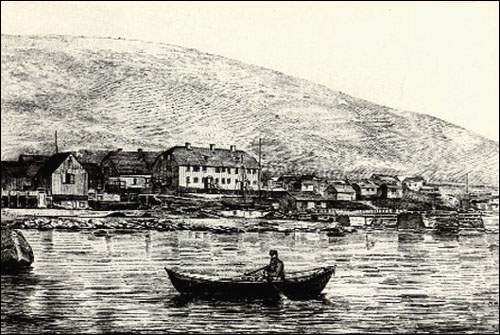
- Nain as viewed from Mt. Sophie, September 2011. (en)
|
| dbp:imageSkyline
|
- Nain, NL as viewed from Mt. Sophie.jpg (en)
|
| dbp:ir
| |
| dbp:janChill
| |
| dbp:janHighC
| |
| dbp:janLowC
| |
| dbp:janMaximumHumidex
| |
| dbp:janMeanC
| |
| dbp:janPrecipitationDays
| |
| dbp:janPrecipitationMm
| |
| dbp:janRainDays
| |
| dbp:janRainMm
| |
| dbp:janRecordHighC
| |
| dbp:janRecordLowC
| |
| dbp:janSnowCm
| |
| dbp:janSnowDays
| |
| dbp:julChill
| |
| dbp:julHighC
| |
| dbp:julLowC
| |
| dbp:julMaximumHumidex
| |
| dbp:julMeanC
| |
| dbp:julPrecipitationDays
| |
| dbp:julPrecipitationMm
| |
| dbp:julRainDays
| |
| dbp:julRainMm
| |
| dbp:julRecordHighC
| |
| dbp:julRecordLowC
| |
| dbp:julSnowCm
| |
| dbp:julSnowDays
| |
| dbp:junChill
| |
| dbp:junHighC
| |
| dbp:junLowC
| |
| dbp:junMaximumHumidex
| |
| dbp:junMeanC
| |
| dbp:junPrecipitationDays
| |
| dbp:junPrecipitationMm
| |
| dbp:junRainDays
| |
| dbp:junRainMm
| |
| dbp:junRecordHighC
| |
| dbp:junRecordLowC
| |
| dbp:junSnowCm
| |
| dbp:junSnowDays
| |
| dbp:leaderName
| |
| dbp:leaderTitle
|
- Mayor (en)
- Federal MP (en)
- Nunatsiavut Assembly members (en)
- Provincial MHA (en)
|
| dbp:location
| |
| dbp:marChill
| |
| dbp:marHighC
| |
| dbp:marLowC
| |
| dbp:marMaximumHumidex
| |
| dbp:marMeanC
| |
| dbp:marPrecipitationDays
| |
| dbp:marPrecipitationMm
| |
| dbp:marRainDays
| |
| dbp:marRainMm
| |
| dbp:marRecordHighC
| |
| dbp:marRecordLowC
| |
| dbp:marSnowCm
| |
| dbp:marSnowDays
| |
| dbp:mayChill
| |
| dbp:mayHighC
| |
| dbp:mayLowC
| |
| dbp:mayMaximumHumidex
| |
| dbp:mayMeanC
| |
| dbp:mayPrecipitationDays
| |
| dbp:mayPrecipitationMm
| |
| dbp:mayRainDays
| |
| dbp:mayRainMm
| |
| dbp:mayRecordHighC
| |
| dbp:mayRecordLowC
| |
| dbp:maySnowCm
| |
| dbp:maySnowDays
| |
| dbp:metricFirst
| |
| dbp:novChill
| |
| dbp:novHighC
| |
| dbp:novLowC
| |
| dbp:novMaximumHumidex
| |
| dbp:novMeanC
| |
| dbp:novPrecipitationDays
| |
| dbp:novPrecipitationMm
| |
| dbp:novRainDays
| |
| dbp:novRainMm
| |
| dbp:novRecordHighC
| |
| dbp:novRecordLowC
| |
| dbp:novSnowCm
| |
| dbp:novSnowDays
| |
| dbp:octChill
| |
| dbp:octHighC
| |
| dbp:octLowC
| |
| dbp:octMaximumHumidex
| |
| dbp:octMeanC
| |
| dbp:octPrecipitationDays
| |
| dbp:octPrecipitationMm
| |
| dbp:octRainDays
| |
| dbp:octRainMm
| |
| dbp:octRecordHighC
| |
| dbp:octRecordLowC
| |
| dbp:octSnowCm
| |
| dbp:octSnowDays
| |
| dbp:officialName
| |
| dbp:otherName
| |
| dbp:populationAsOf
| |
| dbp:populationDensityKm
| |
| dbp:populationTotal
| |
| dbp:postalCode
| |
| dbp:postalCodeType
| |
| dbp:precipitationColour
| |
| dbp:pushpinLabelPosition
| |
| dbp:pushpinMap
|
- Canada Newfoundland and Labrador (en)
|
| dbp:pushpinMapCaption
|
- Location of Nain in the province (en)
|
| dbp:rainColour
| |
| dbp:sepChill
| |
| dbp:sepHighC
| |
| dbp:sepLowC
| |
| dbp:sepMaximumHumidex
| |
| dbp:sepMeanC
| |
| dbp:sepPrecipitationDays
| |
| dbp:sepPrecipitationMm
| |
| dbp:sepRainDays
| |
| dbp:sepRainMm
| |
| dbp:sepRecordHighC
| |
| dbp:sepRecordLowC
| |
| dbp:sepSnowCm
| |
| dbp:sepSnowDays
| |
| dbp:settlementType
| |
| dbp:singleLine
| |
| dbp:snowColour
| |
| dbp:source
| |
| dbp:subdivisionName
| |
| dbp:subdivisionType
| |
| dbp:timezone
| |
| dbp:timezoneDst
|
- Atlantic Daylight Saving Time (en)
|
| dbp:towns
| |
| dbp:unitPrecipitationDays
| |
| dbp:unitRainDays
| |
| dbp:unitSnowDays
| |
| dbp:utcOffset
| |
| dbp:utcOffsetDst
| |
| dbp:wikiPageUsesTemplate
| |
| dbp:yearMaximumHumidex
| |
| dbp:yearRecordHighC
| |
| dcterms:subject
| |
| gold:hypernym
| |
| schema:sameAs
| |
| georss:point
|
- 56.53638888888889 -61.71888888888889
|
| rdf:type
| |
| rdfs:comment
|
- Nain (Inuit language: Nunainguk) is the northernmost permanent settlement in the Canadian province of Newfoundland and Labrador, within the Nunatsiavut region, located about 370 km (230 mi) by air from Happy Valley-Goose Bay. The town was established as a Moravian mission in 1771 by Jens Haven and other missionaries. As of 2021, the population is 1,204 mostly Inuit and mixed Inuit-European. Nain is the administrative capital of the autonomous region of Nunatsiavut. Nain is inaccessible by road and may be reached only by air or sea. (en)
- Nain (en inuktitut : Nunainguk) est le village le plus septentrional de Terre-Neuve-et-Labrador, au Canada, situé dans la région du Nunatsiavut de l'Inuit Nunangat, à environ 370 kilomètres en avion de Happy Valley-Goose Bay.Le village a été établi comme mission morave en 1771 par Jens Haven et d'autres missionnaires.En 2016, la population était de 1 125 personnes principalement inuites et mixtes inuites-européennes. (fr)
- Nain (in lingua inuit: Nunajnguk) è un villaggio del Canada, situato nella provincia di Terranova e Labrador, nel territorio di Nunatsiavut. (it)
- カナダ>ニューファンドランド・ラブラドール州>ネーン ネーン(Nain)とは、カナダ北西部にある、ニューファンドランド・ラブラドール州の町。イェンスヘイヴンらの宣教師により1771年に建設された。Nunatsiavut自治区の中心地である。2007年現在の町人口は約1,100人程度。大半がイヌイットとイヌイット系白人(混血)。 (ja)
- Nain (Inuit: Nunajnguk) is een gemeente in de Canadese provincie Newfoundland en Labrador. Het is de meest noordelijk gelegen permanent bewoonde nederzetting van de provincie. Nain is de administratieve hoofdstad van de autonome regio Nunatsiavut en draagt de officiële status "Inuit community government". De plaats werd in 1771 door de Moravische Broeders gesticht als missiepost ter evangelisatie van de Inuit uit het gebied. (nl)
- Nain ou Naina (na língua Inuit: Nunajnguk) é a localidade permanente mais setentrional na província canadense de Terra Nova e Labrador, localizada a cerca de 370 quilômetros por via aérea de Happy Valley-Goose Bay. A localidade foi estabelecida como uma missão da Morávia em 1771 por e outros missionários. A partir de 2011, a população era de 1.424 habitantes, de etnia principalmente Inuit e mista Inuit-Europeu. (pt)
- Nain är ett samhälle i Kanada. Det ligger i provinsen Newfoundland och Labrador, i den östra delen av landet, 1 600 km nordost om huvudstaden Ottawa. Antalet invånare är 1 188. Terrängen runt Nain är lite kuperad. Havet är nära Nain åt nordost. Den högsta punkten i närheten är 215 meter över havet, 1,5 km söder om Nain. Trakten är glest befolkad. Flygplatsen ligger nära samhället. (sv)
- Нейн (англ. Nain) — містечко в Канаді, у провінції Ньюфаундленд і Лабрадор. (uk)
- Нейн (англ. Nain) — деревня в провинции Ньюфаундленд и Лабрадор, Канада. (ru)
- 内恩(英語:Nain,因纽特语:Nunainguk),是位于加拿大纽芬兰与拉布拉多省最北边的一个建制城镇。 (zh)
- Nain (Inuit-Name: Nunajnguk) ist eine Gemeinde (Town) in der kanadischen Provinz Neufundland und Labrador. Die Gemeinde gehört zur Census Division No. 11. Sie befindet sich an der Ostspitze einer Halbinsel an der nördlichen Ostküste von Labrador. Ein Archipel aus zahlreichen Inseln, darunter die 4,7 km östlich gelegene Insel , trennt Nain vom offenen Meer. Nain ist die nördlichste permanente Siedlung in Labrador. Nain besitzt einen kleinen Flugplatz (IATA: YDP). Die Ortschaft ist üblicherweise per Flugzeug vom 370 km südlich gelegenen Happy Valley-Goose Bay erreichbar. Zwischen Mitte Juni und Mitte November gibt es eine Fährverbindung von Goose Bay entlang der Labradorküste bis nach Nain. (de)
|
| rdfs:label
|
- Nain (Neufundland und Labrador) (de)
- Nain (Canada) (it)
- Nain (Terre-Neuve-et-Labrador) (fr)
- ネーン (カナダ) (ja)
- Nain, Newfoundland and Labrador (en)
- Nain (Canada) (nl)
- Nain (Terra Nova e Labrador) (pt)
- Нейн (ru)
- Nain, Newfoundland och Labrador (sv)
- 内恩 (纽芬兰与拉布拉多省) (zh)
- Нейн (uk)
|
| owl:sameAs
|
- freebase:Nain, Newfoundland and Labrador
- http://viaf.org/viaf/244780930
- http://d-nb.info/gnd/7669631-5
- wikidata:Nain, Newfoundland and Labrador
- geodata:Nain, Newfoundland and Labrador
- http://ceb.dbpedia.org/resource/Nain_(lungsod)
- dbpedia-de:Nain, Newfoundland and Labrador
- dbpedia-fi:Nain, Newfoundland and Labrador
- dbpedia-fr:Nain, Newfoundland and Labrador
- dbpedia-it:Nain, Newfoundland and Labrador
- dbpedia-ja:Nain, Newfoundland and Labrador
- dbpedia-nl:Nain, Newfoundland and Labrador
- dbpedia-pt:Nain, Newfoundland and Labrador
- dbpedia-ru:Nain, Newfoundland and Labrador
- dbpedia-sv:Nain, Newfoundland and Labrador
- dbpedia-uk:Nain, Newfoundland and Labrador
- dbpedia-zh:Nain, Newfoundland and Labrador
- https://global.dbpedia.org/id/34TeR
|
| geo:geometry
|
- POINT(-61.718887329102 56.536388397217)
|
| geo:lat
| |
| geo:long
| |
| prov:wasDerivedFrom
| |
| foaf:depiction
| |
| foaf:isPrimaryTopicOf
| |
| foaf:name
| |
| is dbo:birthPlace
of | |
| is dbo:location
of | |
| is dbo:nearestCity
of | |
| is dbo:residence
of | |
| is dbo:wikiPageDisambiguates
of | |
| is dbo:wikiPageRedirects
of | |
| is dbo:wikiPageWikiLink
of | |
| is dbp:birthPlace
of | |
| is dbp:city
of | |
| is dbp:demoCsd
of | |
| is dbp:location
of | |
| is dbp:municipality
of | |
| is dbp:nearestCity
of | |
| is dbp:residence
of | |
| is dbp:seat
of | |
| is foaf:primaryTopic
of | |


_Labrador.jpg)
_(14781543365).jpg)
_(14781543365).jpg)
_Labrador.jpg)