| dbo:abstract
|
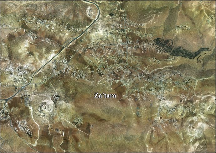
- زعترة هي بَلدة فلسطينية تقع على بُعد 11 كم إلى الجنوب الشرقي من مدينة بيت لحم، حيثُ تقع ضمن محافظة بيت لحم في منتصف الضفة الغربية. حسب الجهاز المركزي للإحصاء الفلسطيني فقد بلغَ تعداد البلدة 6,289 نسمة في عام 2007. (ar)
- Za'atara —en àrab زعتره— és un municipi palestí en la governació de Betlem al centre de Cisjordània, situat 11 kilòmetres al sud-est de Betlem. Segons l'Oficina Central d'Estadístiques de Palestina (PCBS), tenia una població de 7.915 habitants en 2016. En la vespra de guerra araboisraeliana de 1948, i després dels acords d'armistici araboisraelians de 1949, Beit Liqya fou ocupada pel regne haixemita de Jordània. Després de la Guerra dels Sis Dies de 1967 va romandre sota l'ocupació israeliana. (ca)
- Za'atara (Arabic: زعترة) is a Palestinian town located 11 km (6.8 mi) southeast of Bethlehem. The town is in the Bethlehem Governorate central West Bank. According to the Palestinian Central Bureau of Statistics, the town had a population of over 6,289 in 2007. (en)
- Za’atara (arab. زعتره) – palestyńskie miasto położone w muhafazie Betlejem, w Autonomii Palestyńskiej. Według danych Palestyńskiego Centralnego Biura Statystycznego z 2016 liczyło 7 915 mieszkańców. (pl)
|
| dbo:country
| |
| dbo:governmentType
| |
| dbo:populationTotal
|
- 6289 (xsd:nonNegativeInteger)
|
| dbo:subdivision
| |
| dbo:thumbnail
| |
| dbo:wikiPageExternalLink
| |
| dbo:wikiPageID
| |
| dbo:wikiPageLength
|
- 5063 (xsd:nonNegativeInteger)
|
| dbo:wikiPageRevisionID
| |
| dbo:wikiPageWikiLink
| |
| dbp:establishedTitle
| |
| dbp:governmentType
| |
| dbp:gridName
| |
| dbp:imageCaption
| |
| dbp:imageSkyline
|
- PikiWiki_Israel_6114_Herodium.JPG (en)
|
| dbp:name
| |
| dbp:populationAsOf
| |
| dbp:populationDensityKm
| |
| dbp:populationTotal
| |
| dbp:pushpinMap
| |
| dbp:pushpinMapCaption
|
- Location of Za'atara within Palestine (en)
|
| dbp:subdivisionName
| |
| dbp:subdivisionType
| |
| dbp:translitLang
| |
| dbp:translitLang1Info
| |
| dbp:translitLang1Type
| |
| dbp:type
| |
| dbp:unitPref
| |
| dbp:wikiPageUsesTemplate
| |
| dct:subject
| |
| gold:hypernym
| |
| georss:point
|
- 31.675555555555555 35.25555555555555
|
| rdf:type
| |
| rdfs:comment
|
- زعترة هي بَلدة فلسطينية تقع على بُعد 11 كم إلى الجنوب الشرقي من مدينة بيت لحم، حيثُ تقع ضمن محافظة بيت لحم في منتصف الضفة الغربية. حسب الجهاز المركزي للإحصاء الفلسطيني فقد بلغَ تعداد البلدة 6,289 نسمة في عام 2007. (ar)
- Za'atara —en àrab زعتره— és un municipi palestí en la governació de Betlem al centre de Cisjordània, situat 11 kilòmetres al sud-est de Betlem. Segons l'Oficina Central d'Estadístiques de Palestina (PCBS), tenia una població de 7.915 habitants en 2016. En la vespra de guerra araboisraeliana de 1948, i després dels acords d'armistici araboisraelians de 1949, Beit Liqya fou ocupada pel regne haixemita de Jordània. Després de la Guerra dels Sis Dies de 1967 va romandre sota l'ocupació israeliana. (ca)
- Za'atara (Arabic: زعترة) is a Palestinian town located 11 km (6.8 mi) southeast of Bethlehem. The town is in the Bethlehem Governorate central West Bank. According to the Palestinian Central Bureau of Statistics, the town had a population of over 6,289 in 2007. (en)
- Za’atara (arab. زعتره) – palestyńskie miasto położone w muhafazie Betlejem, w Autonomii Palestyńskiej. Według danych Palestyńskiego Centralnego Biura Statystycznego z 2016 liczyło 7 915 mieszkańców. (pl)
|
| rdfs:label
|
- زعترة (بيت لحم) (ar)
- Za'atara (ca)
- Za’atara (pl)
- Za'atara (en)
|
| owl:sameAs
| |
| geo:geometry
|
- POINT(35.255554199219 31.675556182861)
|
| geo:lat
| |
| geo:long
| |
| prov:wasDerivedFrom
| |
| foaf:depiction
| |
| foaf:isPrimaryTopicOf
| |
| foaf:name
| |
| is dbo:wikiPageRedirects
of | |
| is dbo:wikiPageWikiLink
of | |
| is foaf:primaryTopic
of | |


