| dbo:Infrastructure/length
| |
| dbo:abstract
|
- Der Manali-Leh-Highway (auch Leh-Manali-Highway) ist ein 477 Kilometer langer Verkehrsweg in Indien, der die Städte Leh (34° 9′ 52″ N, 77° 35′ 5″ O) im Unionsterritorium Ladakh und Manali (32° 14′ 44″ N, 77° 11′ 14″ O) im Bundesstaat Himachal Pradesh verbindet. Die Straße ist für die indischen Streitkräfte von strategischer Bedeutung, da sie die einzige Alternativroute zur Verbindung Srinagar–Leh (National Highway 1D) ist und im Gegensatz zu dieser weitab der pakistanischen Grenze verläuft. Der Highway ist in vielen Teilen nur einstreifig ausgebaut und nur zwischen Juni und Mitte September geöffnet. (de)
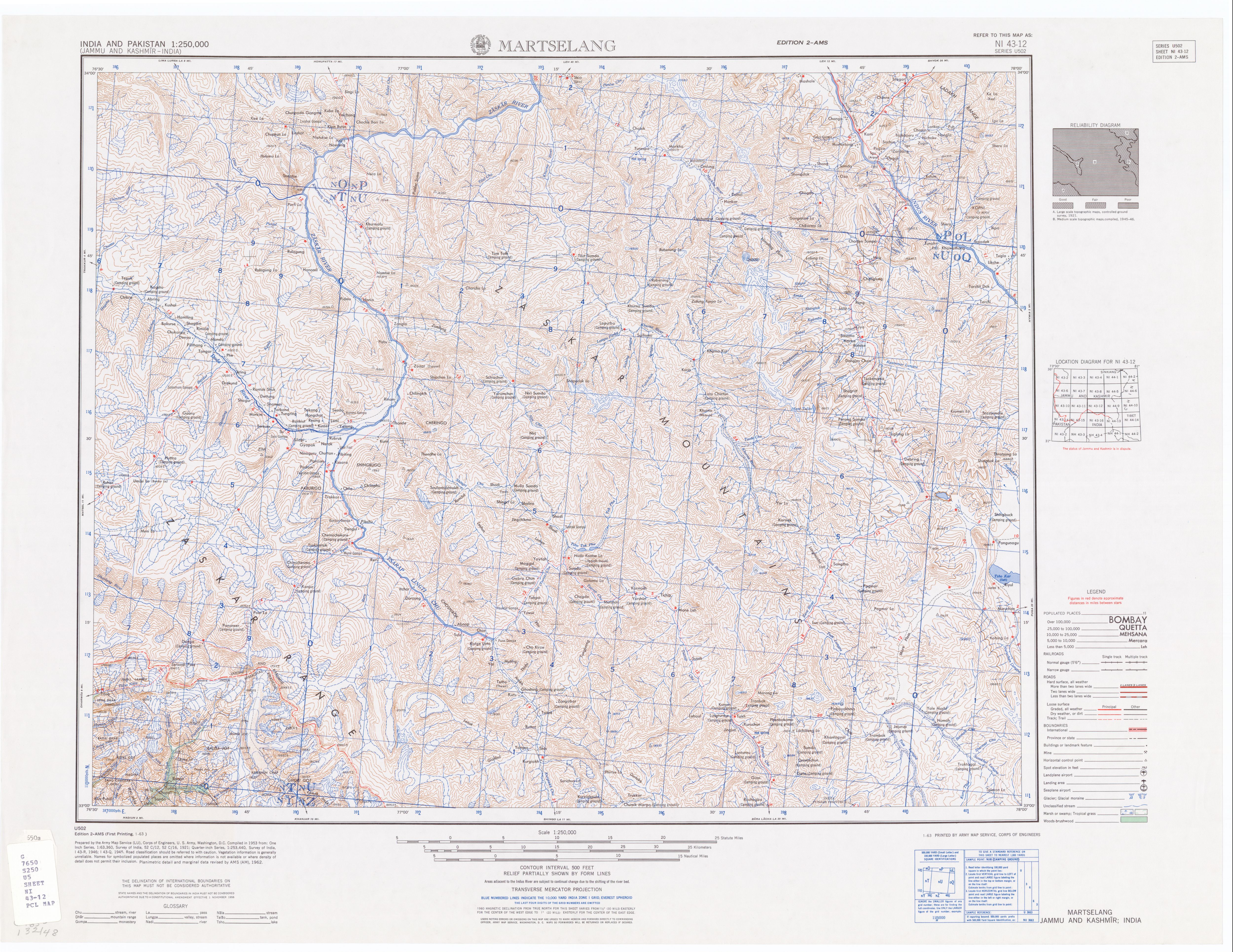
- The Leh–Manali Highway is a 428 km (266 mi) long highway in northernmost India connecting Leh, the capital of the union territory of Ladakh, to Manali in the state of Himachal Pradesh. It connects the Manali Solang valley to the Lahaul and Spiti valleys in Himachal Pradesh and the Zanskar valley in Ladakh. It is open for about six months in a year, from first week of May (when the snow is cleared from the highway) to October, when snowfall again blocks the high passes on the highway. However, the Lahaul valley now remains connected to Manali for most part of the year through already completed Atal tunnel. With the completion of proposed Shingo La Tunnel on new route through Zanskar valley, targeted to be completed by 2025, the whole Leh-Manali route will become all-weather road. The Leh–Manali Highway acts as a trunk route for various India-China Border Roads in Ladakh and Himachal. It has been designed, built and being maintained by the Border Roads Organisation (BRO) of the Indian army. It supports the heaviest army vehicles. (en)
- A estrada Manali–Lé (em inglês: Manali–Leh Highway; em hindi: लेह-मनाली राजमार्ग; romaniz.: Lēha-manālī rājamārga) é uma estrada no norte da Índia, que liga Manali, no estado do Himachal Pradexe, a Lé, no território da União do Ladaque. Tem aproximadamente 475–470 km e só está aberta durante aproximadamente quatro meses e meio por ano, durante o verão, entre maio ou junho, quando a neve é limpa, e meados de outubro, quando a neve volta a bloquear os passos de montanha mais altos, embora haja anos em que permanece aberta durante mais tempo. Não é incomum alguns passos serem encerrados em pleno verão por alguns dias devido às condições meteorológicas e deslizamentos de terras. (pt)
- Лех-Маналинское шоссе (хинди लेह-मनाली राजमार्ग, IAST: Lēha-manālī rājamārga) — шоссе в Индии, соединяющее Лех и Манали. Оно открыто с июня по середину сентября, когда счищает весь снег с шоссе. Эта дорога соединяет Манали с долиной Куллу, Лахулом, Спити и Ладакхом. Оно является частью , которое планируется достроить в 2012. Шоссе пересекает высочайшие перевалы в мире, включая 4892 метров, Лачулунг-Ла 5059 м и Тангланг-Ла 5325 метров. Пересечение перевалов часто затруднено из-за снегопадов.. Между Лачлунгg-Ла и Тагланг-Ла эта дорога пересекает Равнину Мор. строится в обход перевала, чтобы сделать дорогу проходимой, независимо от погоды. Путешествие по дороге обычно занимает 2 дня (часто бывает больше из-за погоды), путники обычно ночуют в или в палаточном лагере . Попеременно можно ночевать и в . Расстояние от Манали до Сарчу — 222 км в Химачал-Прадеш, а от Сарчу до Леха — 257 км, итак, всё шоссе 479 км. Неподготовленные путешественники могут испытывать неприятные ощущения и, возможно, горную болезнь. Проектирование, финансирование и строительство дороги осуществлялось индийской армией. Шоссе было изначально рассчитано на перемещение военной техники. (ru)
|
| dbo:length
|
- 428000.000000 (xsd:double)
|
| dbo:routeEnd
| |
| dbo:routeEndDirection
| |
| dbo:routeStart
| |
| dbo:routeStartDirection
| |
| dbo:thumbnail
| |
| dbo:wikiPageExternalLink
| |
| dbo:wikiPageID
| |
| dbo:wikiPageLength
|
- 18973 (xsd:nonNegativeInteger)
|
| dbo:wikiPageRevisionID
| |
| dbo:wikiPageWikiLink
| |
| dbp:country
| |
| dbp:destinations
|
- Leh (en)
- (en)
- Tandi (en)
- Karu (en)
- Shey (en)
- Manali (en)
- Darcha (en)
- Gya (en)
- Jispa (en)
- Keylong (en)
- Koksar (en)
- Rohtang (en)
- Sarchu (en)
- Gramphu (en)
- Patseo (en)
- Sissu (en)
- Upshi (en)
- Zingzingbar (en)
|
| dbp:directionA
| |
| dbp:directionB
| |
| dbp:imageNotes
| |
| dbp:lengthKm
| |
| dbp:mapCustom
| |
| dbp:name
| |
| dbp:states
| |
| dbp:terminusA
| |
| dbp:terminusB
| |
| dbp:wikiPageUsesTemplate
| |
| dcterms:subject
| |
| gold:hypernym
| |
| georss:point
| |
| rdf:type
| |
| rdfs:comment
|
- Der Manali-Leh-Highway (auch Leh-Manali-Highway) ist ein 477 Kilometer langer Verkehrsweg in Indien, der die Städte Leh (34° 9′ 52″ N, 77° 35′ 5″ O) im Unionsterritorium Ladakh und Manali (32° 14′ 44″ N, 77° 11′ 14″ O) im Bundesstaat Himachal Pradesh verbindet. Die Straße ist für die indischen Streitkräfte von strategischer Bedeutung, da sie die einzige Alternativroute zur Verbindung Srinagar–Leh (National Highway 1D) ist und im Gegensatz zu dieser weitab der pakistanischen Grenze verläuft. Der Highway ist in vielen Teilen nur einstreifig ausgebaut und nur zwischen Juni und Mitte September geöffnet. (de)
- A estrada Manali–Lé (em inglês: Manali–Leh Highway; em hindi: लेह-मनाली राजमार्ग; romaniz.: Lēha-manālī rājamārga) é uma estrada no norte da Índia, que liga Manali, no estado do Himachal Pradexe, a Lé, no território da União do Ladaque. Tem aproximadamente 475–470 km e só está aberta durante aproximadamente quatro meses e meio por ano, durante o verão, entre maio ou junho, quando a neve é limpa, e meados de outubro, quando a neve volta a bloquear os passos de montanha mais altos, embora haja anos em que permanece aberta durante mais tempo. Não é incomum alguns passos serem encerrados em pleno verão por alguns dias devido às condições meteorológicas e deslizamentos de terras. (pt)
- The Leh–Manali Highway is a 428 km (266 mi) long highway in northernmost India connecting Leh, the capital of the union territory of Ladakh, to Manali in the state of Himachal Pradesh. It connects the Manali Solang valley to the Lahaul and Spiti valleys in Himachal Pradesh and the Zanskar valley in Ladakh. It is open for about six months in a year, from first week of May (when the snow is cleared from the highway) to October, when snowfall again blocks the high passes on the highway. However, the Lahaul valley now remains connected to Manali for most part of the year through already completed Atal tunnel. With the completion of proposed Shingo La Tunnel on new route through Zanskar valley, targeted to be completed by 2025, the whole Leh-Manali route will become all-weather road. (en)
- Лех-Маналинское шоссе (хинди लेह-मनाली राजमार्ग, IAST: Lēha-manālī rājamārga) — шоссе в Индии, соединяющее Лех и Манали. Оно открыто с июня по середину сентября, когда счищает весь снег с шоссе. Эта дорога соединяет Манали с долиной Куллу, Лахулом, Спити и Ладакхом. Оно является частью , которое планируется достроить в 2012. Проектирование, финансирование и строительство дороги осуществлялось индийской армией. Шоссе было изначально рассчитано на перемещение военной техники. (ru)
|
| rdfs:label
|
- Manali-Leh-Highway (de)
- Leh–Manali Highway (en)
- Estrada Manali–Lé (pt)
- Лех-Манальское шоссе (ru)
|
| owl:sameAs
| |
| geo:geometry
|
- POINT(77.190505981445 32.249580383301)
|
| geo:lat
| |
| geo:long
| |
| prov:wasDerivedFrom
| |
| foaf:depiction
| |
| foaf:isPrimaryTopicOf
| |
| foaf:name
| |
| is dbo:wikiPageRedirects
of | |
| is dbo:wikiPageWikiLink
of | |
| is dbp:traversed
of | |
| is foaf:primaryTopic
of | |


.jpg)
.jpg)