| dbo:abstract
|
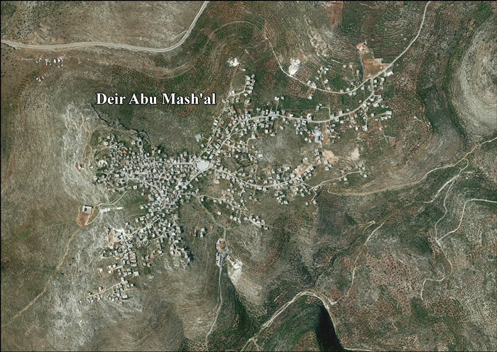
- دير أبو مشعل هي قرية فلسطينية تقع في الضفة الغربية من أراض السلطة الفلسطينية. وتتبع محافظة رام الله والبيرة وقعت تحت الاحتلال الإسرائيلي في حرب 1967. دير أبو مشعل تقع قرية دير أبو مشعل على بعد 30 كم شمال غرب مدينة رام الله، وترتفع عن سطح البحر حوالي 460 م، وتبلغ مساحتها الكلية 8778 دونماً، ومساحة المنطقة المبنية فيها 425 دونماً، وتحيط بالقرية أراضي عابود، وبيتللو، وجمالا، وشقبا. يبلغ عدد سكان القرية 3358 نسمة حسب تقديرات الجهاز المركزي للإحصاء الفلسطيني لعام 2004.يوجد في القرية موقع أثري هو عبارة عن برك رومانية، علاوةً على انتشار الخرب الأثرية حولها، ومنها خربة الرشنية وتقع شرق القرية، وكذلك خربة إرطبة وتقع إلى الجنوب من القرية. (ar)
- Deir Abu Mash'al (àrab: دير ابو مشعل, Dayr Abū Maxʿal) és una vila palestina en la governació de Ramal·lah i al-Bireh al centre de Cisjordània, situada 24 kilòmetres a l'oest de Ramal·lah. Segons l'Oficina Central d'Estadístiques de Palestina (PCBS), tenia una població de 4.507 habitants en 2016. (ca)
- Deir Abu Mash'al (Arabic: دير ابو مشعل) is a Palestinian village in the Ramallah and al-Bireh Governorate, located 24 kilometers (15 mi) west of Ramallah in the northern West Bank. According to the Palestinian Central Bureau of Statistics (PCBS), the village had a population of approximately 3,522 inhabitants in 2007. Donde nació Ibrahim salem (en)
- Dajr Abu Masz'al (arab. دير ابو مشعل, Dayr Abū Maxʿal) – wieś w Palestynie, w muhafazie Ramallah i Al-Bira. Według danych szacunkowych Palestyńskiego Centralnego Biura Statystycznego w 2016 roku miejscowość liczyła 4507 mieszkańców. (pl)
|
| dbo:country
| |
| dbo:governmentType
| |
| dbo:politicalLeader
| |
| dbo:populationTotal
|
- 3522 (xsd:nonNegativeInteger)
|
| dbo:subdivision
| |
| dbo:thumbnail
| |
| dbo:wikiPageExternalLink
| |
| dbo:wikiPageID
| |
| dbo:wikiPageLength
|
- 19489 (xsd:nonNegativeInteger)
|
| dbo:wikiPageRevisionID
| |
| dbo:wikiPageWikiLink
| |
| dbp:blankInfoSec
|
- The monastery with the cresset (en)
|
| dbp:blankNameSec
| |
| dbp:establishedTitle
| |
| dbp:governmentType
| |
| dbp:gridName
| |
| dbp:gridPosition
| |
| dbp:imageCaption
| |
| dbp:imageSkyline
|
- DirAbuMashal4236.jpg (en)
|
| dbp:leaderName
|
- Ibrahim Mohammad Yousi Zhran (en)
|
| dbp:leaderTitle
|
- Head of Municipality (en)
|
| dbp:name
| |
| dbp:populationAsOf
| |
| dbp:populationDensityKm
| |
| dbp:populationTotal
| |
| dbp:pushpinMap
| |
| dbp:pushpinMapCaption
|
- Location of Deir Abu Mash'al within Palestine (en)
|
| dbp:subdivisionName
| |
| dbp:subdivisionType
| |
| dbp:translitLang
| |
| dbp:translitLang1Info
| |
| dbp:translitLang1Type
| |
| dbp:type
| |
| dbp:unitPref
| |
| dbp:wikiPageUsesTemplate
| |
| dcterms:subject
| |
| gold:hypernym
| |
| schema:sameAs
| |
| georss:point
|
- 31.998333333333335 35.068333333333335
|
| rdf:type
| |
| rdfs:comment
|
- دير أبو مشعل هي قرية فلسطينية تقع في الضفة الغربية من أراض السلطة الفلسطينية. وتتبع محافظة رام الله والبيرة وقعت تحت الاحتلال الإسرائيلي في حرب 1967. دير أبو مشعل تقع قرية دير أبو مشعل على بعد 30 كم شمال غرب مدينة رام الله، وترتفع عن سطح البحر حوالي 460 م، وتبلغ مساحتها الكلية 8778 دونماً، ومساحة المنطقة المبنية فيها 425 دونماً، وتحيط بالقرية أراضي عابود، وبيتللو، وجمالا، وشقبا. يبلغ عدد سكان القرية 3358 نسمة حسب تقديرات الجهاز المركزي للإحصاء الفلسطيني لعام 2004.يوجد في القرية موقع أثري هو عبارة عن برك رومانية، علاوةً على انتشار الخرب الأثرية حولها، ومنها خربة الرشنية وتقع شرق القرية، وكذلك خربة إرطبة وتقع إلى الجنوب من القرية. (ar)
- Deir Abu Mash'al (àrab: دير ابو مشعل, Dayr Abū Maxʿal) és una vila palestina en la governació de Ramal·lah i al-Bireh al centre de Cisjordània, situada 24 kilòmetres a l'oest de Ramal·lah. Segons l'Oficina Central d'Estadístiques de Palestina (PCBS), tenia una població de 4.507 habitants en 2016. (ca)
- Deir Abu Mash'al (Arabic: دير ابو مشعل) is a Palestinian village in the Ramallah and al-Bireh Governorate, located 24 kilometers (15 mi) west of Ramallah in the northern West Bank. According to the Palestinian Central Bureau of Statistics (PCBS), the village had a population of approximately 3,522 inhabitants in 2007. Donde nació Ibrahim salem (en)
- Dajr Abu Masz'al (arab. دير ابو مشعل, Dayr Abū Maxʿal) – wieś w Palestynie, w muhafazie Ramallah i Al-Bira. Według danych szacunkowych Palestyńskiego Centralnego Biura Statystycznego w 2016 roku miejscowość liczyła 4507 mieszkańców. (pl)
|
| rdfs:label
|
- دير أبو مشعل (ar)
- Deir Abu Mash'al (en)
- Deir Abu Mash'al (ca)
- Dajr Abu Masz'al (pl)
|
| owl:sameAs
| |
| geo:geometry
|
- POINT(35.068332672119 31.998332977295)
|
| geo:lat
| |
| geo:long
| |
| prov:wasDerivedFrom
| |
| foaf:depiction
| |
| foaf:isPrimaryTopicOf
| |
| foaf:name
| |
| is dbo:wikiPageRedirects
of | |
| is dbo:wikiPageWikiLink
of | |
| is foaf:primaryTopic
of | |


