| dbo:abstract
|
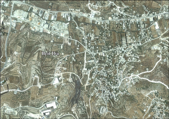
- Beit Iba —en àrab بيت إيبا, Bayt Ībā— és un vila palestina de la governació de Nablus, a Cisjordània, al nord de la vall del Jordà, 7 kilòmetres al nord-oest de Nablus. Segons l'Oficina Central Palestina d'Estadístiques tenia una població de 3.268 habitants en 2007. (ca)
- بيت إيبا أو بيت تيبا قرية من قرى محافظة نابلس، تقعُ إلى الشمال الغربي من مدينة نابلس على الطريق الرئيسي (نابلس – طولكرم) حيث أصبحت البلدة متشابكة مع المدينة من الناحية الغربية نتيجة التوسع العمراني لمدينة نابلس باتجاه البلدة و حيث تتبع لمجلس قروي مستقبل (ar)
- Beit Iba (Arabic: بيت إيبا) is a Palestinian village in the Nablus Governorate in the North central West Bank, located 7 kilometers northwest of Nablus. According to the Palestinian Central Bureau of Statistics (PCBS), the village had a population of 3,268 inhabitants in mid-year 2006. (en)
|
| dbo:country
| |
| dbo:governmentType
| |
| dbo:populationTotal
|
- 3268 (xsd:nonNegativeInteger)
|
| dbo:subdivision
| |
| dbo:thumbnail
| |
| dbo:wikiPageExternalLink
| |
| dbo:wikiPageID
| |
| dbo:wikiPageLength
|
- 11568 (xsd:nonNegativeInteger)
|
| dbo:wikiPageRevisionID
| |
| dbo:wikiPageWikiLink
| |
| dbp:blankInfoSec
| |
| dbp:blankNameSec
| |
| dbp:establishedTitle
| |
| dbp:governmentType
| |
| dbp:gridName
| |
| dbp:gridPosition
| |
| dbp:imageCaption
| |
| dbp:imageSkyline
| |
| dbp:name
| |
| dbp:populationAsOf
| |
| dbp:populationDensityKm
| |
| dbp:populationTotal
| |
| dbp:pushpinMap
| |
| dbp:pushpinMapCaption
|
- Location of Beit Iba within Palestine (en)
|
| dbp:subdivisionName
| |
| dbp:subdivisionType
| |
| dbp:translitLang
| |
| dbp:translitLang1Info
|
- Bayt Iba (en)
- بيت إيبا (en)
|
| dbp:translitLang1Type
| |
| dbp:type
| |
| dbp:unitPref
| |
| dbp:wikiPageUsesTemplate
| |
| dcterms:subject
| |
| gold:hypernym
| |
| georss:point
|
- 32.236111111111114 35.209722222222226
|
| rdf:type
| |
| rdfs:comment
|
- Beit Iba —en àrab بيت إيبا, Bayt Ībā— és un vila palestina de la governació de Nablus, a Cisjordània, al nord de la vall del Jordà, 7 kilòmetres al nord-oest de Nablus. Segons l'Oficina Central Palestina d'Estadístiques tenia una població de 3.268 habitants en 2007. (ca)
- بيت إيبا أو بيت تيبا قرية من قرى محافظة نابلس، تقعُ إلى الشمال الغربي من مدينة نابلس على الطريق الرئيسي (نابلس – طولكرم) حيث أصبحت البلدة متشابكة مع المدينة من الناحية الغربية نتيجة التوسع العمراني لمدينة نابلس باتجاه البلدة و حيث تتبع لمجلس قروي مستقبل (ar)
- Beit Iba (Arabic: بيت إيبا) is a Palestinian village in the Nablus Governorate in the North central West Bank, located 7 kilometers northwest of Nablus. According to the Palestinian Central Bureau of Statistics (PCBS), the village had a population of 3,268 inhabitants in mid-year 2006. (en)
|
| rdfs:label
|
- Beit Iba (en)
- بيت إيبا (ar)
- Beit Iba (ca)
|
| owl:sameAs
| |
| geo:geometry
|
- POINT(35.209720611572 32.236110687256)
|
| geo:lat
| |
| geo:long
| |
| prov:wasDerivedFrom
| |
| foaf:depiction
| |
| foaf:isPrimaryTopicOf
| |
| foaf:name
| |
| is dbo:wikiPageWikiLink
of | |
| is foaf:primaryTopic
of | |


