| dbo:PopulatedPlace/areaTotal
| |
| dbo:abstract
|
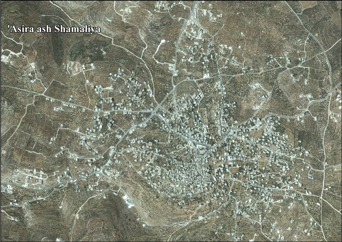
- Asira ash-Shamaliya —en àrab عصيرة الشماليّة, ʿAṣīra ax-Xamāliyya— és un municipi palestí de la governació de Nablus, a Cisjordània, al nord de la vall del Jordà, 6 kilòmetres al nord de Nablus. Segons l'Oficina Central Palestina d'Estadístiques, tenia una població de 7.556 habitants en 2007. En àrab, la paraula ʿaṣīra vol dir «llenya» i es refereix a l'abundància de boscos a la ciutat, que van ser utilitzats pels residents per vendre'n la llenya. (ca)
- عَصيرَة الشماليَّة بلدة فلسطينية تتبع محافظة نابلس شمال الضفة الغربية. بلغ عدد سكانها حسب الجهاز المركزي للإحصاء الفلسطيني حوالي 8,813 نسمة حسب التعداد العام للسكان الذي أجري عام 2017. وهي من البلدات المحتلة عام النكسة. (ar)
- Asira ash-Shamaliya (Arabic: عصيرة الشماليّة) is a Palestinian town in the Nablus Governorate, located 3.5 kilometers north of Nablus in the northern West Bank. According to the Palestinian Central Bureau of Statistics, the town had a population of approximately 7,556 inhabitants in 2007. (en)
- Asira ash-Shamaliya (عصيرة الشمالية en arabe) est un village montagneux palestinien situé dans le gouvernorat de Naplouse. Sa population a été estimée à 2336 habitants lors du recensement de 2007 par le Bureau central palestinien des statistiques . Le nom de ce village tient son origine du cananéen signifiant pressoir à raisins, destiné à la préparation du vin à l’époque romaine ou pressoir d'huile d'olive. Ce nom serait également lié à ses paysages montagneux et ses routes cahoteuses rendant la marche difficile. (fr)
- Asira sz-Szamalijja (arab. عصيرة الشماليّة) – palestyńskie miasto położone w muhafazie Nablus, w Autonomii Palestyńskiej. Według danych szacunkowych Palestyńskiego Centralnego Biura Statystycznego w 2016 roku miejscowość liczyła 9169 mieszkańców (pl)
|
| dbo:areaTotal
|
- 29400000.000000 (xsd:double)
|
| dbo:country
| |
| dbo:governmentType
| |
| dbo:politicalLeader
| |
| dbo:populationTotal
|
- 7556 (xsd:nonNegativeInteger)
|
| dbo:subdivision
| |
| dbo:thumbnail
| |
| dbo:wikiPageExternalLink
| |
| dbo:wikiPageID
| |
| dbo:wikiPageLength
|
- 15853 (xsd:nonNegativeInteger)
|
| dbo:wikiPageRevisionID
| |
| dbo:wikiPageWikiLink
| |
| dbp:areaTotalDunam
| |
| dbp:areaTotalKm
| |
| dbp:blankInfoSec
|
- "firewood of the north". Old: Asiret el Hatab, The difficult place of timber (en)
|
| dbp:blankNameSec
| |
| dbp:establishedTitle
| |
| dbp:governmentType
| |
| dbp:gridName
| |
| dbp:gridPosition
| |
| dbp:imageCaption
| |
| dbp:imageSkyline
|
- Asira_al_Shamaliya-4.jpg (en)
|
| dbp:leaderName
|
- Mohammad Mahmoud Jawabra (en)
|
| dbp:leaderTitle
|
- Head of Municipality (en)
|
| dbp:name
| |
| dbp:populationAsOf
| |
| dbp:populationDensityKm
| |
| dbp:populationTotal
| |
| dbp:pushpinMap
| |
| dbp:pushpinMapCaption
|
- Location of Asira ash-Shamaliya within Palestine (en)
|
| dbp:subdivisionName
| |
| dbp:subdivisionType
| |
| dbp:translitLang
| |
| dbp:translitLang1Info
|
- 'Asira ash-Shamaliyah (en)
- Asira al-Shamaliyeh (en)
- عصيرة الشماليّة (en)
|
| dbp:translitLang1Type
| |
| dbp:type
| |
| dbp:unitPref
| |
| dbp:website
| |
| dbp:wikiPageUsesTemplate
| |
| dcterms:subject
| |
| gold:hypernym
| |
| schema:sameAs
| |
| georss:point
|
- 32.25055555555556 35.26694444444445
|
| rdf:type
| |
| rdfs:comment
|
- Asira ash-Shamaliya —en àrab عصيرة الشماليّة, ʿAṣīra ax-Xamāliyya— és un municipi palestí de la governació de Nablus, a Cisjordània, al nord de la vall del Jordà, 6 kilòmetres al nord de Nablus. Segons l'Oficina Central Palestina d'Estadístiques, tenia una població de 7.556 habitants en 2007. En àrab, la paraula ʿaṣīra vol dir «llenya» i es refereix a l'abundància de boscos a la ciutat, que van ser utilitzats pels residents per vendre'n la llenya. (ca)
- عَصيرَة الشماليَّة بلدة فلسطينية تتبع محافظة نابلس شمال الضفة الغربية. بلغ عدد سكانها حسب الجهاز المركزي للإحصاء الفلسطيني حوالي 8,813 نسمة حسب التعداد العام للسكان الذي أجري عام 2017. وهي من البلدات المحتلة عام النكسة. (ar)
- Asira ash-Shamaliya (Arabic: عصيرة الشماليّة) is a Palestinian town in the Nablus Governorate, located 3.5 kilometers north of Nablus in the northern West Bank. According to the Palestinian Central Bureau of Statistics, the town had a population of approximately 7,556 inhabitants in 2007. (en)
- Asira ash-Shamaliya (عصيرة الشمالية en arabe) est un village montagneux palestinien situé dans le gouvernorat de Naplouse. Sa population a été estimée à 2336 habitants lors du recensement de 2007 par le Bureau central palestinien des statistiques . Le nom de ce village tient son origine du cananéen signifiant pressoir à raisins, destiné à la préparation du vin à l’époque romaine ou pressoir d'huile d'olive. Ce nom serait également lié à ses paysages montagneux et ses routes cahoteuses rendant la marche difficile. (fr)
- Asira sz-Szamalijja (arab. عصيرة الشماليّة) – palestyńskie miasto położone w muhafazie Nablus, w Autonomii Palestyńskiej. Według danych szacunkowych Palestyńskiego Centralnego Biura Statystycznego w 2016 roku miejscowość liczyła 9169 mieszkańców (pl)
|
| rdfs:label
|
- Asira ash-Shamaliya (en)
- عصيرة الشمالية (ar)
- Asira ash-Shamaliya (ca)
- Asira ash-Shamaliya (fr)
- Asira asz-Szamalijja (pl)
|
| owl:sameAs
| |
| geo:geometry
|
- POINT(35.266944885254 32.250556945801)
|
| geo:lat
| |
| geo:long
| |
| prov:wasDerivedFrom
| |
| foaf:depiction
| |
| foaf:homepage
| |
| foaf:isPrimaryTopicOf
| |
| foaf:name
| |
| is dbo:birthPlace
of | |
| is dbo:wikiPageRedirects
of | |
| is dbo:wikiPageWikiLink
of | |
| is dbp:birthPlace
of | |
| is foaf:primaryTopic
of | |


