| dbo:abstract
|
- المزرعة الشرقية بلدة فلسطينية في محافظة رام الله والبيرة. (ar)
- Al-Mazra'a ash-Sharqiya (àrab: المزرعه الشرقيّه, al-Mazraʿa ax-Xarqiyya) és un municipi palestí de la governació de Ramal·lah i al-Bireh, al centre de Cisjordània, situat 15 kilòmetres al nord-oest de Ramal·lah. Segons l'Oficina Central d'Estadístiques de Palestina (PCBS), tenia una població de 5.752 habitants en 2016. Es troba 950 metres per sobre el nivell del mar, al sud-est del Mont Aasor. Limita al nord amb la vila de Turmus Ayya, al sud amb Silwad i les viles de Kafr Malik, Deir Jarir i Abu Falah. La ciutat té moltes mansions grans i elaborades, per la qual raó és coneguda com el "Miami de Cisjordània", segons la BBC. (ca)
- al-Mazra'a ash-Sharqiya (Arabic: المزرعه الشرقيّه) is a Palestinian town in the Ramallah and al-Bireh Governorate, located northeast of Ramallah in the northern West Bank. According to the Palestinian Central Bureau of Statistics (PCBS), the town had a population of approximately 4,495 inhabitants in 2007. (en)
- Al-Mazra’a asz-Szarkijja (arab. المزرعة الشرقية, Al-Mazraʿa aš-Šārqiyya) – miasto w Palestynie, w muhafazie Ramallah i Al-Bira. Według danych szacunkowych Palestyńskiego Centralnego Biura Statystycznego w 2016 roku miejscowość liczyła 5752 mieszkańców. (pl)
|
| dbo:country
| |
| dbo:elevation
| |
| dbo:governmentType
| |
| dbo:populationTotal
|
- 4495 (xsd:nonNegativeInteger)
|
| dbo:subdivision
| |
| dbo:thumbnail
| |
| dbo:wikiPageExternalLink
| |
| dbo:wikiPageID
| |
| dbo:wikiPageLength
|
- 17378 (xsd:nonNegativeInteger)
|
| dbo:wikiPageRevisionID
| |
| dbo:wikiPageWikiLink
| |
| dbp:blankInfoSec
|
- "The eastern sown land" (en)
|
| dbp:blankNameSec
| |
| dbp:elevationM
| |
| dbp:establishedTitle
| |
| dbp:governmentType
| |
| dbp:gridName
| |
| dbp:gridPosition
| |
| dbp:imageCaption
|
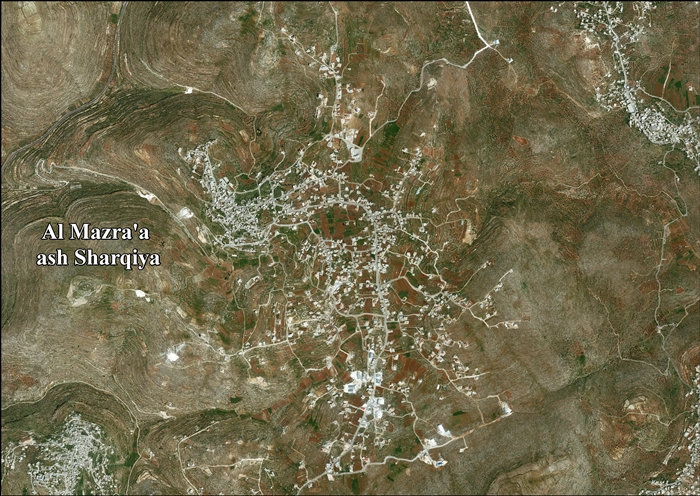
- Yabrud in front, al-Mazra'a ash-Sharqiya behind (en)
|
| dbp:imageSkyline
| |
| dbp:name
|
- al-Mazra'a ash-Sharqiya (en)
|
| dbp:populationAsOf
| |
| dbp:populationDensityKm
| |
| dbp:populationTotal
| |
| dbp:pushpinMap
| |
| dbp:pushpinMapCaption
|
- Location of al-Mazra'a ash-Sharqiya within Palestine (en)
|
| dbp:subdivisionName
| |
| dbp:subdivisionType
| |
| dbp:translitLang
| |
| dbp:translitLang1Info
| |
| dbp:translitLang1Type
| |
| dbp:type
| |
| dbp:unitPref
| |
| dbp:wikiPageUsesTemplate
| |
| dcterms:subject
| |
| gold:hypernym
| |
| schema:sameAs
| |
| georss:point
|
- 32.00333333333333 35.27305555555556
|
| rdf:type
| |
| rdfs:comment
|
- المزرعة الشرقية بلدة فلسطينية في محافظة رام الله والبيرة. (ar)
- al-Mazra'a ash-Sharqiya (Arabic: المزرعه الشرقيّه) is a Palestinian town in the Ramallah and al-Bireh Governorate, located northeast of Ramallah in the northern West Bank. According to the Palestinian Central Bureau of Statistics (PCBS), the town had a population of approximately 4,495 inhabitants in 2007. (en)
- Al-Mazra’a asz-Szarkijja (arab. المزرعة الشرقية, Al-Mazraʿa aš-Šārqiyya) – miasto w Palestynie, w muhafazie Ramallah i Al-Bira. Według danych szacunkowych Palestyńskiego Centralnego Biura Statystycznego w 2016 roku miejscowość liczyła 5752 mieszkańców. (pl)
- Al-Mazra'a ash-Sharqiya (àrab: المزرعه الشرقيّه, al-Mazraʿa ax-Xarqiyya) és un municipi palestí de la governació de Ramal·lah i al-Bireh, al centre de Cisjordània, situat 15 kilòmetres al nord-oest de Ramal·lah. Segons l'Oficina Central d'Estadístiques de Palestina (PCBS), tenia una població de 5.752 habitants en 2016. Es troba 950 metres per sobre el nivell del mar, al sud-est del Mont Aasor. Limita al nord amb la vila de Turmus Ayya, al sud amb Silwad i les viles de Kafr Malik, Deir Jarir i Abu Falah. (ca)
|
| rdfs:label
|
- المزرعة الشرقية (ar)
- Al-Mazra'a ash-Sharqiya (ca)
- Al-Mazra'a ash-Sharqiya (en)
- Al-Mazra’a asz-Szarkijja (pl)
|
| owl:sameAs
| |
| geo:geometry
|
- POINT(35.273056030273 32.00333404541)
|
| geo:lat
| |
| geo:long
| |
| prov:wasDerivedFrom
| |
| foaf:depiction
| |
| foaf:isPrimaryTopicOf
| |
| foaf:name
|
- al-Mazra'a ash-Sharqiya (en)
|
| is dbo:wikiPageRedirects
of | |
| is dbo:wikiPageWikiLink
of | |
| is foaf:primaryTopic
of | |


