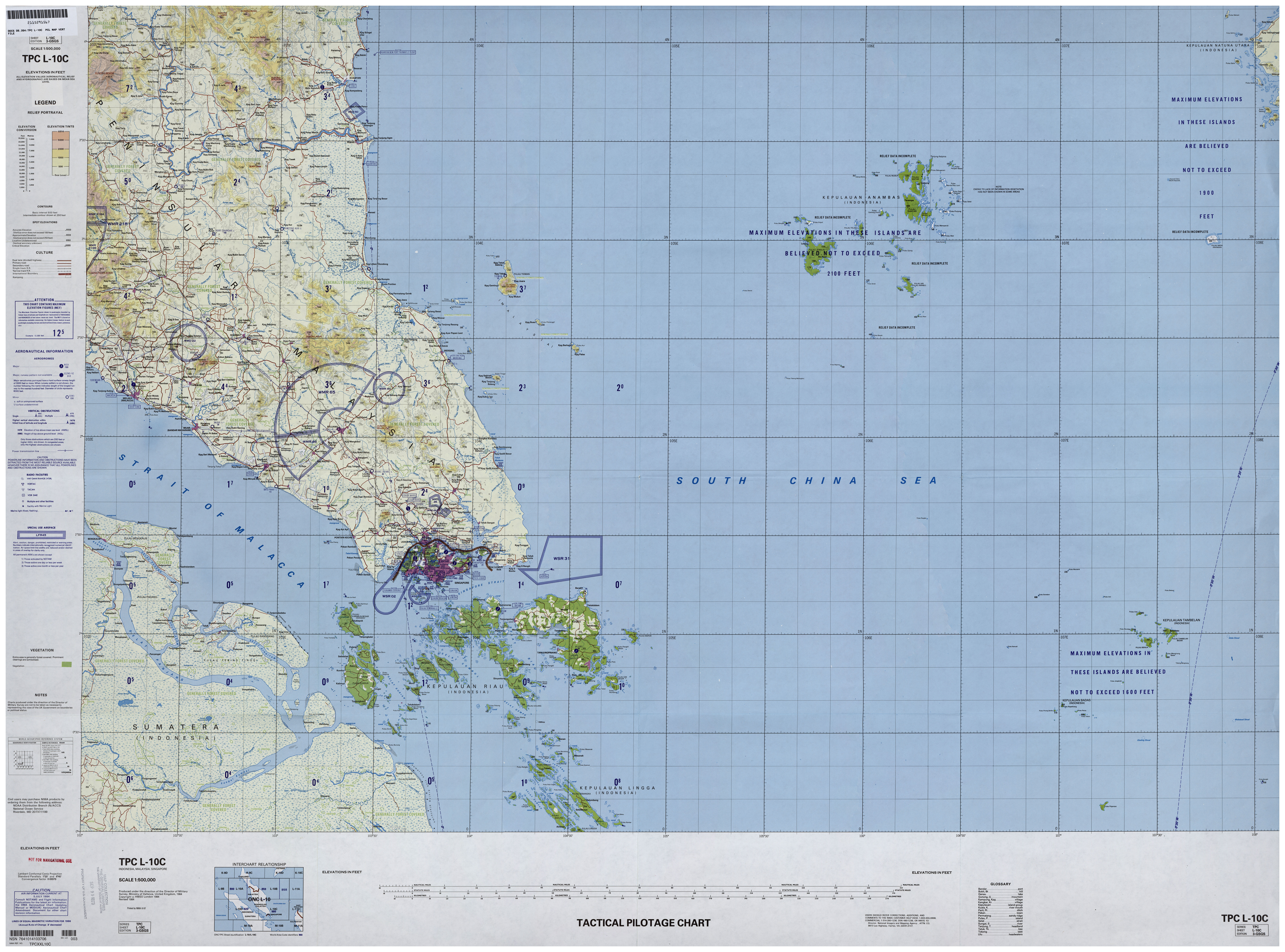
Badas Islands is a group of islands in the Tudjuh Archipelago in the South China Sea between the Malaysian mainland to the west and the island of Borneo to the east. Administratively it is part of Bintan Regency within the Riau Islands province of Indonesia under island district/kecamatan of Tambelan.
| Attributes | Values |
|---|
| rdf:type
| |
| rdfs:label
| - جزر باداس (ar)
- Badasinseln (de)
- Badas Islands (en)
- 巴達斯群島 (zh)
|
| rdfs:comment
| - Die Badasinseln (indonesisch Kepulauan Badas, ehemals Saint Esprit Islands) sind eine indonesische Inselgruppe im Südchinesischen Meer. (de)
- 巴達斯群島是印度尼西亞的群島,屬於圖朱群島的一部分,位於東面婆羅洲和西面馬來西亞大陸之間的南中國海,東北面56公里有淡美蘭群島,行政方面由廖內群島省負責管轄。 (zh)
- جزر باداس هي مجموعة جزر تتبع أرخبيل توجوه وتقع في بحر الصين الجنوبي بين الجزء الماليزي من شبه جزيرة الملايو من جهة الغرب وجزيرة بورنيو من جهة الشرق . إدراياً الجزر تتبع مقاطعة جزر رياو الإندونيسية . تقع الجزر على مسافة 56 كيلومترا إلى الجنوب الغربي من أرخبيل تامبيلان، وتقع خارج الممرات الملاحية المعتادة. جزيرة أناكاور هي الجزيرة التي تقع في أقصى جنوب غرب مجموعة الجزر وترتفع حتى 94 متراً، ولها شاطئ رملي على الجانب الجنوبي الغربي، ولكن الساحل وعر. جزيرة بيجامو تقع على مسافة 17 كيلومترا من جزيرة أناكاور ، وترتفع إلى 42 متراً ، وتتميز بغابات ، . هناك شاطئ رملي على جانبها الشرقي. (ar)
- Badas Islands is a group of islands in the Tudjuh Archipelago in the South China Sea between the Malaysian mainland to the west and the island of Borneo to the east. Administratively it is part of Bintan Regency within the Riau Islands province of Indonesia under island district/kecamatan of Tambelan. (en)
|
| geo:lat
| |
| geo:long
| |
| dcterms:subject
| |
| Wikipage page ID
| |
| Wikipage revision ID
| |
| Link from a Wikipage to another Wikipage
| |
| Link from a Wikipage to an external page
| |
| sameAs
| |
| dbp:wikiPageUsesTemplate
| |
| georss:point
| |
| has abstract
| - جزر باداس هي مجموعة جزر تتبع أرخبيل توجوه وتقع في بحر الصين الجنوبي بين الجزء الماليزي من شبه جزيرة الملايو من جهة الغرب وجزيرة بورنيو من جهة الشرق . إدراياً الجزر تتبع مقاطعة جزر رياو الإندونيسية . تقع الجزر على مسافة 56 كيلومترا إلى الجنوب الغربي من أرخبيل تامبيلان، وتقع خارج الممرات الملاحية المعتادة. جزيرة أناكاور هي الجزيرة التي تقع في أقصى جنوب غرب مجموعة الجزر وترتفع حتى 94 متراً، ولها شاطئ رملي على الجانب الجنوبي الغربي، ولكن الساحل وعر. جزيرة بيجامو تقع على مسافة 17 كيلومترا من جزيرة أناكاور ، وترتفع إلى 42 متراً ، وتتميز بغابات ، . هناك شاطئ رملي على جانبها الشرقي. جزيرة كيباهلانغ هي أكبر جزيرة المجموعة وتقع في شمالها. ترتفع حتى 252 متراً ، ويتميز الجانبين الشمالي والشرقي بسلسلة صخور جافة. هناك خليج صغير في الجانب الشمالي الشرقي من الجزيرة والتي هي أكبر مستوطنة في الجزيرة. (ar)
- Badas Islands is a group of islands in the Tudjuh Archipelago in the South China Sea between the Malaysian mainland to the west and the island of Borneo to the east. Administratively it is part of Bintan Regency within the Riau Islands province of Indonesia under island district/kecamatan of Tambelan. The Badas Islands are located between 0°30'N and 0°39'N latitude, and between 106°58'E and 107°12'E longitude. They are 56 km southwest of the Tambelan archipelago (of which district they are administratively part), and lie outside the usual shipping lanes. The southwesternmost island of the group is Anakawur Island (Pulau Anakawur) (0°33′10″N 106°58′39″E / 0.552837°N 106.977478°E) which rises to 94 m and has a sandy beach on its southwestern side, but otherwise has a rugged coastline. Pejamu Island (Pulau Pejamu) (0°30′53″N 107°09′02″E / 0.514726°N 107.150443°E) which lies 17 km east-southeast of Anakawur, is densely forested and rises to 42 m. There is a sandy beach on its east side. Kepahiang Island (Pulau Kepahiang) (0°38′57″N 107°00′56″E / 0.649271°N 107.015564°E) is the largest and northernmost island of the group. It rises to 252 m and the northern and eastern sides are fringed by a drying reef. There is a small bay on the northeast side of the island above which is the largest settlement on the island. (en)
- Die Badasinseln (indonesisch Kepulauan Badas, ehemals Saint Esprit Islands) sind eine indonesische Inselgruppe im Südchinesischen Meer. (de)
- 巴達斯群島是印度尼西亞的群島,屬於圖朱群島的一部分,位於東面婆羅洲和西面馬來西亞大陸之間的南中國海,東北面56公里有淡美蘭群島,行政方面由廖內群島省負責管轄。 (zh)
|
| gold:hypernym
| |
| prov:wasDerivedFrom
| |
| page length (characters) of wiki page
| |
| foaf:isPrimaryTopicOf
| |
| geo:geometry
| - POINT(106.97747802734 0.5528370141983)
|
| is Link from a Wikipage to another Wikipage
of | |
| is Wikipage disambiguates
of | |
| is foaf:primaryTopic
of | |


![[RDF Data]](/fct/images/sw-rdf-blue.png)


![[RDF Data]](/fct/images/sw-rdf-blue.png)


![[cxml]](/fct/images/cxml_doc.png)
![[csv]](/fct/images/csv_doc.png)
![[text]](/fct/images/ntriples_doc.png)
![[turtle]](/fct/images/n3turtle_doc.png)
![[ld+json]](/fct/images/jsonld_doc.png)
![[rdf+json]](/fct/images/json_doc.png)
![[rdf+xml]](/fct/images/xml_doc.png)
![[atom+xml]](/fct/images/atom_doc.png)
![[html]](/fct/images/html_doc.png)