Browse using
OpenLink Faceted Browser
OpenLink Structured Data Editor
LodLive Browser
Formats
RDF:
N-Triples
N3
Turtle
JSON
XML
OData:
Atom
JSON
Microdata:
JSON
HTML
Embedded:
JSON
Turtle
Other:
CSV
JSON-LD
Faceted Browser
Sparql Endpoint
About:
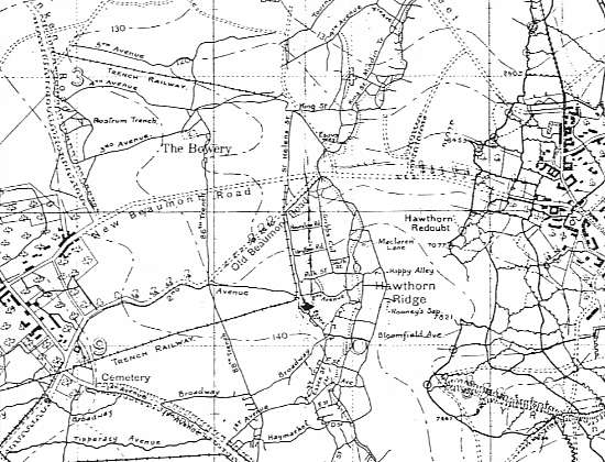
Trench map
An Entity of Type:
Thing
,
from Named Graph:
http://dbpedia.org
,
within Data Space:
dbpedia.org
unknown
Property
Value
dbo:
thumbnail
wiki-commons
:Special:FilePath/Lone_Pine_-_ANZAC_trench_&_tunnel_map.png?width=300
dbo:
wikiPageExternalLink
http://www.worldwar1.com/maps/sb078.jpg
dbo:
wikiPageWikiLink
dbr
:The_National_Archives_(United_Kingdom)
dbr
:Lithographic_limestone
dbr
:First_Battle_of_the_Aisne
dbr
:Cartography
dbr
:Lithography
dbr
:Kew
dbr
:Trench_warfare
dbc
:Trench_warfare
dbr
:Imperial_War_Museum
dbr
:Front_line
dbc
:Map_types
dbc
:Military_cartography
dbr
:Great_War
dbr
:Race_for_the_Sea
dbr
:Map_scale
dbr
:File:Lone_Pine_-_ANZAC_trench_&_tunnel_map.png
dbr
:File:Third_Battle_of_Ypres_-_German_trench_lines_(Sept_1917).jpg
dbp:
wikiPageUsesTemplate
dbt
:ISBN
dbt
:No_footnotes
dct:
subject
dbc
:Trench_warfare
dbc
:Military_cartography
dbc
:Military_maps
rdfs:
label
Trench map
(en)
owl:
sameAs
freebase
:Trench map
wikidata
:Trench map
dbpedia-global
:Trench map
prov:
wasDerivedFrom
wikipedia-en
:Trench_map?oldid=1189425265&ns=0
foaf:
depiction
wiki-commons
:Special:FilePath/Lone_Pine_-_ANZAC_trench_&_tunnel_map.png
wiki-commons
:Special:FilePath/Third_Battle_of_Ypres_-_German_trench_lines_(Sept_1917).jpg
foaf:
isPrimaryTopicOf
wikipedia-en
:Trench_map
is
dbo:
wikiPageWikiLink
of
dbr
:Antiques_Roadshow_(series_28)
dbr
:Battle_of_Vimy_Ridge
dbr
:Imperial_War_Museum
is
foaf:
primaryTopic
of
wikipedia-en
:Trench_map
This content was extracted from
Wikipedia
and is licensed under the
Creative Commons Attribution-ShareAlike 4.0 International


.jpg)
.jpg)