| dbo:alternativeName
| |
| dbo:description
|
- سلسلة جبلية في الهند (ar)
- mountains in India (en)
- sléibhte san India (ga)
- हिमालय की सबसे पूर्वी उपशृंखला (hi)
|
| dbo:locatedInArea
| |
| dbo:thumbnail
| |
| dbo:wikiPageExternalLink
| |
| dbo:wikiPageWikiLink
| |
| dbp:location
|
- Mêdog County, Nyingchi Prefecture, China (en)
|
| dbp:name
| |
| dbp:otherName
| |
| dbp:photo
|
- Yarlung Tsangpo river tibet.jpg (en)
|
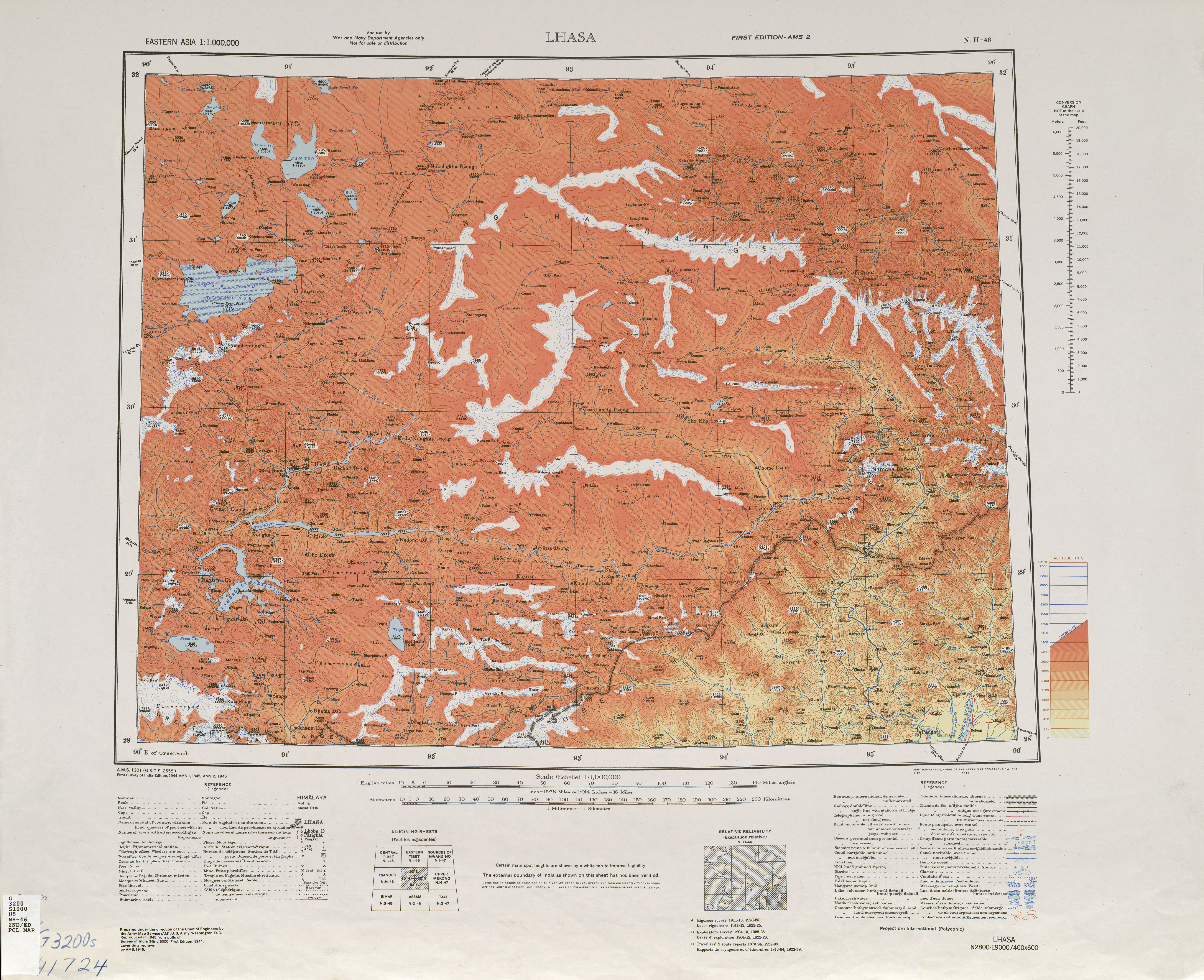
| dbp:photoCaption
|
- Satellite view of Namcha Barwa Himal range surrounded by Great Bend of the Yarlung Tsangpo River . Namcha Barwa Himal range runs diagonally from bottom left to top right corner, and Naamcha Barwa peak is in the top right at the end of the range. Gyala Peri peak in the Nyenchen Tanglha Shan range is just 20 km north of Naamcha Barwa peak across the Yarlung Tsangpo River. (en)
|
| dbp:wikiPageUsesTemplate
| |
| dct:subject
| |
| gold:hypernym
| |
| georss:point
|
- 29.629166666666666 95.05583333333334
|
| rdf:type
| |
| rdfs:label
|
- Namcha Barwa Himal (en)
- Namcha Barwa Himal (ca)
|
| owl:sameAs
| |
| geo:geometry
|
- POINT(95.05583190918 29.629167556763)
|
| geo:lat
| |
| geo:long
| |
| prov:wasDerivedFrom
| |
| foaf:depiction
| |
| foaf:isPrimaryTopicOf
| |
| foaf:name
| |
| is dbo:mountainRange
of | |
| is dbo:wikiPageRedirects
of | |
| is dbo:wikiPageWikiLink
of | |
| is dbp:range
of | |
| is foaf:primaryTopic
of | |


