About: Xalbal River Goto Sponge NotDistinct Permalink
An Entity of Type : umbel-rc:Stream,
within Data Space : dbpedia.org associated with source document(s)

![http://dbpedia.org/describe/?url=http%3A%2F%2Fdbpedia.org%2Fresource%2FXalbal_River]()

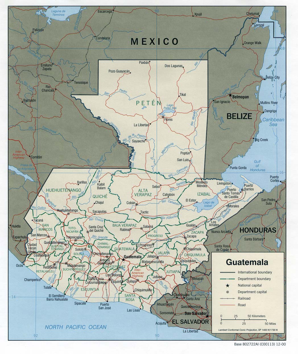
The Xalbal River (Spanish pronunciation: [ʃalˈβal]) is a river of Guatemala. Its sources are in the Sierra de los Cuchumatanes (at 15°29′52″N 91°07′58″W / 15.497769°N 91.132793°W) in the department of El Quiché, where the river is called Río Xaclbal or Río Chajul. The Xaclbal river flows northwards down the tropical lowlands of Ixcan where it is called Río Xalbal (at 15°57′17″N 90°55′31″W / 15.954727°N 90.925255°W), and crosses the border with Mexico, where it joins the Lacantún River, a tributary of the Usumacinta river. The Guatemalan part of Xaclbal river basin covers an area of 1,366 square kilometres (527 sq mi).
| Attributes | Values |
|---|---|
| rdf:type |
|
| rdfs:label |
|
| rdfs:comment |
|
| foaf:name |
|
| name |
|
| geo:lat |
|
| geo:long |
|
| foaf:depiction | |
| dcterms:subject | |
| Wikipage page ID |
|
| Wikipage revision ID |
|
| Link from a Wikipage to another Wikipage | |
| Link from a Wikipage to an external page | |
| sameAs | |
| source1 location |
|
| dbp:wikiPageUsesTemplate | |
| thumbnail | |
| image caption |
|
| subdivision name |
|
| subdivision type |
|
| georss:point |
|
| has abstract |
|
| mouth location |
|
| mouth mountain | |
| mouth place | |
| gold:hypernym | |
| prov:wasDerivedFrom | |
| page length (characters) of wiki page |
|
| foaf:isPrimaryTopicOf | |
| geo:geometry |
|
| is Link from a Wikipage to another Wikipage of | |
| is Wikipage redirect of | |
| is dam crosses of | |
| is river of | |
| is foaf:primaryTopic of |
Faceted Search & Find service v1.17_git139 as of Feb 29 2024


![[RDF Data]](/fct/images/sw-rdf-blue.png)

OpenLink Virtuoso version 08.03.3330 as of Mar 19 2024, on Linux (x86_64-generic-linux-glibc212), Single-Server Edition (62 GB total memory, 43 GB memory in use)
Data on this page belongs to its respective rights holders.
Virtuoso Faceted Browser Copyright © 2009-2024 OpenLink Software


![[RDF Data]](/fct/images/sw-rdf-blue.png)
OpenLink Virtuoso version 08.03.3330 as of Mar 19 2024, on Linux (x86_64-generic-linux-glibc212), Single-Server Edition (62 GB total memory, 43 GB memory in use)
Data on this page belongs to its respective rights holders.
Virtuoso Faceted Browser Copyright © 2009-2024 OpenLink Software


![[cxml]](/fct/images/cxml_doc.png)
![[csv]](/fct/images/csv_doc.png)
![[text]](/fct/images/ntriples_doc.png)
![[turtle]](/fct/images/n3turtle_doc.png)
![[ld+json]](/fct/images/jsonld_doc.png)
![[rdf+json]](/fct/images/json_doc.png)
![[rdf+xml]](/fct/images/xml_doc.png)
![[atom+xml]](/fct/images/atom_doc.png)
![[html]](/fct/images/html_doc.png)