About: Pate Hole Goto Sponge NotDistinct Permalink
An Entity of Type : yago:YagoPermanentlyLocatedEntity,
within Data Space : dbpedia.org associated with source document(s)

![http://dbpedia.org/c/8ixiX4mTW5]()

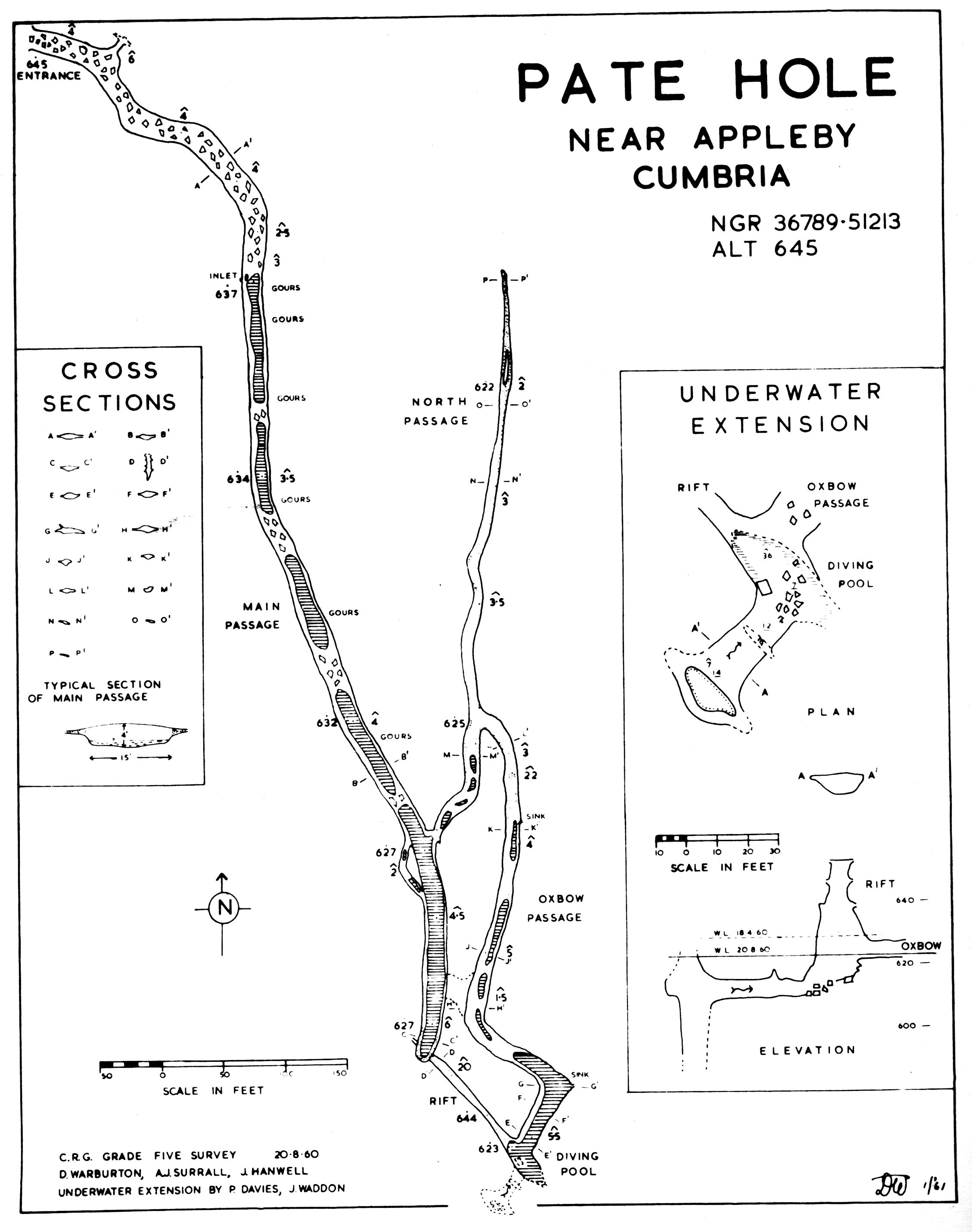
Pate Hole is a solutional cave located adjacent to Asby Gill 1 kilometre (0.62 mi) south of Great Asby in Cumbria, England. It is 970 metres (3,180 ft) long and has a vertical range of 33 metres (108 ft). The entrance is normally dry, but in flood it becomes an impressive resurgence. Its name derives from the north country word for badger. The cave is formed in Carboniferous limestone, and is thought to drain the Great Asby Scar area 3 kilometres (1.9 mi) to the south-west. The resurgence is presumed to be St. Thomas's Well in Great Asby.
| Attributes | Values |
|---|---|
| rdf:type |
|
| rdfs:label |
|
| rdfs:comment |
|
| foaf:name |
|
| name |
|
| geo:lat |
|
| geo:long |
|
| foaf:depiction | |
| location | |
| dct:subject | |
| Wikipage page ID |
|
| Wikipage revision ID |
|
| Link from a Wikipage to another Wikipage | |
| Link from a Wikipage to an external page | |
| sameAs | |
| dbp:wikiPageUsesTemplate | |
| thumbnail | |
| survey | |
| location |
|
| map caption |
|
| photo |
|
| photo caption |
|
| georss:point |
|
| has abstract |
|
| difficulty |
|
| entrance count |
|
| geology |
|
| grid ref UK |
|
| hazards |
|
| gold:hypernym | |
| depth (μ) |
|
| prov:wasDerivedFrom | |
| page length (characters) of wiki page |
|
| length (μ) |
|
| foaf:isPrimaryTopicOf | |
| geo:geometry |
|
| is Link from a Wikipage to another Wikipage of | |
| is Wikipage redirect of | |
| is foaf:primaryTopic of |
Faceted Search & Find service v1.17_git147 as of Sep 06 2024


![[RDF Data]](/fct/images/sw-rdf-blue.png)

OpenLink Virtuoso version 08.03.3331 as of Sep 2 2024, on Linux (x86_64-generic-linux-glibc212), Single-Server Edition (378 GB total memory, 51 GB memory in use)
Data on this page belongs to its respective rights holders.
Virtuoso Faceted Browser Copyright © 2009-2024 OpenLink Software


![[RDF Data]](/fct/images/sw-rdf-blue.png)
OpenLink Virtuoso version 08.03.3331 as of Sep 2 2024, on Linux (x86_64-generic-linux-glibc212), Single-Server Edition (378 GB total memory, 51 GB memory in use)
Data on this page belongs to its respective rights holders.
Virtuoso Faceted Browser Copyright © 2009-2024 OpenLink Software


![[cxml]](/fct/images/cxml_doc.png)
![[csv]](/fct/images/csv_doc.png)
![[text]](/fct/images/ntriples_doc.png)
![[turtle]](/fct/images/n3turtle_doc.png)
![[ld+json]](/fct/images/jsonld_doc.png)
![[rdf+json]](/fct/images/json_doc.png)
![[rdf+xml]](/fct/images/xml_doc.png)
![[atom+xml]](/fct/images/atom_doc.png)
![[html]](/fct/images/html_doc.png)