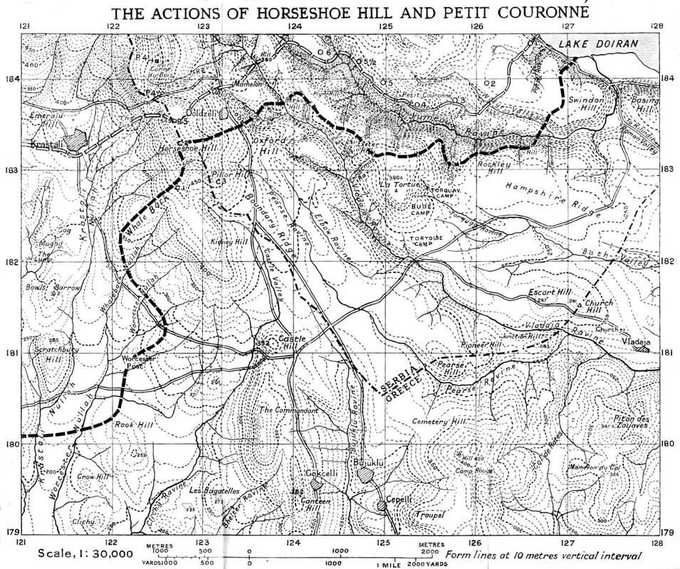
Korona (Greek: Κορώνα) is a village in Kilkis regional unit of Central Macedonia, Greece. It is situated in the municipal unit of Polykastro, in the Paionia municipality, within the Kilkis region of Central Macedonia. According to the 2011 census has a population of 44 permanent residents. The old name of the village was Krastali (Greek: Κράσταλη), until it changed to its current name in 1926.
| Attributes | Values |
|---|
| rdf:type
| |
| rdfs:label
| - Κορώνα Κιλκίς (el)
- Korona, Kilkis (en)
|
| rdfs:comment
| - Η Κορώνα είναι χωριό του Δήμου Παιονίας, της Περιφερειακής Ενότητας Κιλκίς, κοντά στα σύνορα Ελλάδας και Βόρειας Μακεδονίας, νοτιοδυτικά της λίμνης Δοϊράνης σε υψόμετρο 350 μέτρα. Η πλειοψηφία των κατοίκων κατάγονται από τον Πόντο. Οι παλαιότεροι κάτοικοι ήταν μουσουλμάνοι και προσέφυγαν στην Τουρκία κατά την ανταλλαγή πληθυσμών του 1923. Η παλαιότερη ονομασία του χωριού ήταν Κράσταλη. Είναι χτισμένη στους πρόποδες του ομώνυμου λόφου (υψόμετρο 665 μ.), η κορυφή του οποίου αποτελεί και το σύνορο μεταξύ Ελλάδας και Βόρειας Μακεδονίας. Η ονομασία του λόφου οφείλεται στον Α΄ Παγκόσμιο Πόλεμο, όταν οι Γάλλοι ονόμασαν το λόφο "Γκραν Κορνέ" (Μεγάλο Κέρας). (el)
- Korona (Greek: Κορώνα) is a village in Kilkis regional unit of Central Macedonia, Greece. It is situated in the municipal unit of Polykastro, in the Paionia municipality, within the Kilkis region of Central Macedonia. According to the 2011 census has a population of 44 permanent residents. The old name of the village was Krastali (Greek: Κράσταλη), until it changed to its current name in 1926. (en)
|
| foaf:name
| |
| name
| |
| geo:lat
| |
| geo:long
| |
| foaf:depiction
| |
| dcterms:subject
| |
| Wikipage page ID
| |
| Wikipage revision ID
| |
| Link from a Wikipage to another Wikipage
| |
| Link from a Wikipage to an external page
| |
| sameAs
| |
| dbp:wikiPageUsesTemplate
| |
| thumbnail
| |
| area code
| |
| elevation
| |
| image map
| |
| map caption
| - Location within the regional unit (en)
|
| population as of
| |
| postal code
| |
| georss:point
| |
| has abstract
| - Η Κορώνα είναι χωριό του Δήμου Παιονίας, της Περιφερειακής Ενότητας Κιλκίς, κοντά στα σύνορα Ελλάδας και Βόρειας Μακεδονίας, νοτιοδυτικά της λίμνης Δοϊράνης σε υψόμετρο 350 μέτρα. Η πλειοψηφία των κατοίκων κατάγονται από τον Πόντο. Οι παλαιότεροι κάτοικοι ήταν μουσουλμάνοι και προσέφυγαν στην Τουρκία κατά την ανταλλαγή πληθυσμών του 1923. Η παλαιότερη ονομασία του χωριού ήταν Κράσταλη. Είναι χτισμένη στους πρόποδες του ομώνυμου λόφου (υψόμετρο 665 μ.), η κορυφή του οποίου αποτελεί και το σύνορο μεταξύ Ελλάδας και Βόρειας Μακεδονίας. Η ονομασία του λόφου οφείλεται στον Α΄ Παγκόσμιο Πόλεμο, όταν οι Γάλλοι ονόμασαν το λόφο "Γκραν Κορνέ" (Μεγάλο Κέρας). Αναφέρεται με την παλιά του ονομασία Κράσταλη μετά την απελευθέρωση στο ΦΕΚ 48Α - 05/03/1919 να ορίζεται έδρα ομώνυμης κοινότητας και το 1926 με το ΦΕΚ 346Α - 04/10/1926 να μετονομάζεται σε Κορώνα. Σύμφωνα με το σχέδιο Καλλικράτης αποτελεί την τοπική κοινότητα Κορώνας που ανήκει στη δημοτική ενότητα Πολυκάστρου του Δήμου Παιονίας και σύμφωνα με την απογραφή του 2011 έχει πληθυσμό 44 κατοίκους. (el)
- Korona (Greek: Κορώνα) is a village in Kilkis regional unit of Central Macedonia, Greece. It is situated in the municipal unit of Polykastro, in the Paionia municipality, within the Kilkis region of Central Macedonia. According to the 2011 census has a population of 44 permanent residents. The old name of the village was Krastali (Greek: Κράσταλη), until it changed to its current name in 1926. In the early twentieth century Krastali was a Turkish village in the Gevgelija said of the Ottoman Empire. After the Second Balkan War in 1913 the village was under Greek sovereignty. Its population emigrated to Turkey and was replaced by Greek refugees who resettled there. In 1928 the village was entirely refugee with 32 families and 91 refugees. The village is situated at the foot of the ominous hill (altitude 665 m.), the top of which is the border between Greece and North Macedonia. The name of the hill is due to the First World War, when the French named the hill (French: Grand Couronne). This translates as - Greek: Μεγάλη κορώνα - hence the new name of the village. (en)
|
| licence
| |
| municipality
| |
| municunit
| |
| name local
| |
| periph
| |
| periphunit
| |
| pop community
| |
| prov:wasDerivedFrom
| |
| page length (characters) of wiki page
| |
| area code
| |
| postal code
| |
| country
| |
| foaf:isPrimaryTopicOf
| |
| geo:geometry
| - POINT(22.668899536133 41.164199829102)
|
| is Link from a Wikipage to another Wikipage
of | |
| is foaf:primaryTopic
of | |

![http://dbpedia.org/describe/?url=http%3A%2F%2Fdbpedia.org%2Fresource%2FKorona%2C_Kilkis]()


![[RDF Data]](/fct/images/sw-rdf-blue.png)


![[RDF Data]](/fct/images/sw-rdf-blue.png)


![[cxml]](/fct/images/cxml_doc.png)
![[csv]](/fct/images/csv_doc.png)
![[text]](/fct/images/ntriples_doc.png)
![[turtle]](/fct/images/n3turtle_doc.png)
![[ld+json]](/fct/images/jsonld_doc.png)
![[rdf+json]](/fct/images/json_doc.png)
![[rdf+xml]](/fct/images/xml_doc.png)
![[atom+xml]](/fct/images/atom_doc.png)
![[html]](/fct/images/html_doc.png)