About: Comal River Goto Sponge NotDistinct Permalink
An Entity of Type : umbel-rc:Stream,
within Data Space : dbpedia.org associated with source document(s)

![http://dbpedia.org/describe/?url=http%3A%2F%2Fdbpedia.org%2Fresource%2FComal_River&graph=http%3A%2F%2Fdbpedia.org&graph=http%3A%2F%2Fdbpedia.org]()

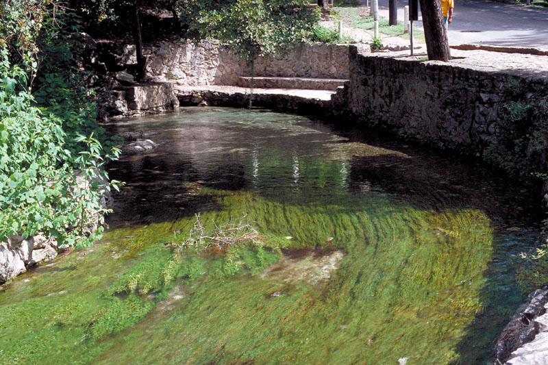
The Comal River (/ˈkoʊmæl/ KOH-mal) is the shortest navigable river in the state of Texas in the United States. Proclaimed the "longest shortest river in the world" by locals, it runs entirely within the city limits of New Braunfels in southeast Comal County. It is a tributary of the Guadalupe River. The Comal begins at Comal Springs in Landa Park and flows 2.5 miles (4.0 km) until its junction with the Guadalupe. The river is also one of only two rivers to host the fountain darter, a fish now in danger of extinction. The only other river inhabited by the darter is the nearby San Marcos River.
Faceted Search & Find service v1.17_git139 as of Feb 29 2024


![[RDF Data]](/fct/images/sw-rdf-blue.png)

OpenLink Virtuoso version 08.03.3330 as of Mar 19 2024, on Linux (x86_64-generic-linux-glibc212), Single-Server Edition (61 GB total memory, 51 GB memory in use)
Data on this page belongs to its respective rights holders.
Virtuoso Faceted Browser Copyright © 2009-2024 OpenLink Software


![[RDF Data]](/fct/images/sw-rdf-blue.png)
OpenLink Virtuoso version 08.03.3330 as of Mar 19 2024, on Linux (x86_64-generic-linux-glibc212), Single-Server Edition (61 GB total memory, 51 GB memory in use)
Data on this page belongs to its respective rights holders.
Virtuoso Faceted Browser Copyright © 2009-2024 OpenLink Software


![[cxml]](/fct/images/cxml_doc.png)
![[csv]](/fct/images/csv_doc.png)
![[text]](/fct/images/ntriples_doc.png)
![[turtle]](/fct/images/n3turtle_doc.png)
![[ld+json]](/fct/images/jsonld_doc.png)
![[rdf+json]](/fct/images/json_doc.png)
![[rdf+xml]](/fct/images/xml_doc.png)
![[atom+xml]](/fct/images/atom_doc.png)
![[html]](/fct/images/html_doc.png)