| dbo:Infrastructure/length
| |
| dbo:abstract
|
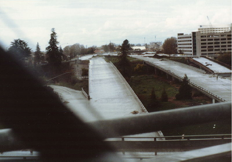
- State Route 87 (SR 87), known as the Guadalupe Freeway or referred to by the locals as Highway 87, is a north–south state highway in San Jose, California, United States. Before being upgraded to a freeway, it was Guadalupe Parkway (and some signs still refer to it that way). For most of its length, especially in Downtown San Jose, the highway follows the course of the Guadalupe River. Its southern terminus is at SR 85, and its northern terminus is at U.S. Route 101 (US 101) just north of San Jose International Airport. Unusually, it crosses over Interstate 880 (I-880) without an interchange. (en)
- La Ruta Estatal de California 87, y abreviada SR 87 (en inglés: California State Route 87) es una carretera estatal estadounidense ubicada en el estado de California. La carretera inicia en el Sur desde la SR 85 en San José hacia el Norte en la US 101 en San José. La carretera tiene una longitud de 14,5 km (9 mi). (es)
- 87号加利福尼亚州州道(California State Route 87)是加利福尼亚州的一条高速公路,长14千米,穿越旧金山湾区南湾,搭载有大量往返硅谷的通勤者。 (zh)
|
| dbo:length
|
- 14484.096000 (xsd:double)
|
| dbo:routeEnd
| |
| dbo:routeEndDirection
| |
| dbo:routeJunction
| |
| dbo:routeNumber
| |
| dbo:routeStart
| |
| dbo:routeStartDirection
| |
| dbo:routeTypeAbbreviation
| |
| dbo:thumbnail
| |
| dbo:wikiPageExternalLink
| |
| dbo:wikiPageID
| |
| dbo:wikiPageLength
|
- 17732 (xsd:nonNegativeInteger)
|
| dbo:wikiPageRevisionID
| |
| dbo:wikiPageWikiLink
| |
| dbp:alternateName
| |
| dbp:counties
| |
| dbp:county
| |
| dbp:deleted
| |
| dbp:directionA
| |
| dbp:directionB
| |
| dbp:espan
| |
| dbp:established
| |
| dbp:exit
|
- 4 (xsd:integer)
- 5 (xsd:integer)
- 6 (xsd:integer)
- 7 (xsd:integer)
- 8 (xsd:integer)
- 391 (xsd:integer)
- — (en)
- 9.0
- 1C (en)
- 1.0
- 3.0
- 1.0
- 1.0
- 3.0
- 9.0
|
| dbp:formed
| |
| dbp:junction
| |
| dbp:lengthMi
| |
| dbp:lengthRound
| |
| dbp:location
| |
| dbp:maint
| |
| dbp:mapNotes
|
- SR 87 highlighted in red (en)
|
| dbp:mile
|
- 0 (xsd:integer)
- 1.340000 (xsd:double)
- 2.830000 (xsd:double)
- 3.350000 (xsd:double)
- 4.120000 (xsd:double)
- 5.150000 (xsd:double)
- 5.560000 (xsd:double)
- 6.100000 (xsd:double)
- 6.800000 (xsd:double)
- 8.310000 (xsd:double)
- 9.220000 (xsd:double)
- none (en)
|
| dbp:mspan
| |
| dbp:nextRoute
| |
| dbp:nextType
| |
| dbp:notes
|
- Southbound exit and northbound entrance (en)
- Northbound exit and southbound entrance (en)
- Northbound exit only (en)
- Northbound access from C/D lanes; signed as exit 6B southbound; St. James St. not signed northbound (en)
- Closed, as the proximity to both the Guadalupe River and San Jose International Airport makes the construction of ramps impractical (en)
- C/D lanes provide northbound access to Santa Clara St. and Julian St. exits; signed as exit 6A southbound; Park Ave. not signed northbound, Auzerais St. not signed southbound (en)
- I-280 exit 3A (en)
- Northbound exit only; accessible from C/D lanes (en)
- Northern terminus; US 101 south exit 390 (en)
- SPUI; opened in 2004; former intersection (en)
- Signed as exit 1 northbound (en)
- Signed as exit 3 northbound (en)
- Single-point urban interchange ; opened in 2003-05 (en)
- Southern terminus; SR 85 exit 5A (en)
- Southern terminus; SR 85 exit 5B (en)
- Closed in 2002 during construction of northern freeway segment; former southbound exit and northbound entrance (en)
- Closed in 2004 during construction of northern freeway segment; former intersection (en)
|
| dbp:previousRoute
| |
| dbp:previousType
| |
| dbp:road
|
- Skyport Drive – Mineta San Jose International Airport (en)
- Alma Avenue (en)
- Almaden Expressway (en)
- Capitol Expressway Auto Mall (en)
- Curtner Avenue (en)
- Hedding Street (en)
- Julian Street / St. James Street (en)
- Market Street, Coleman Ave (en)
- North First Street (en)
- Santa Teresa Boulevard (en)
- Taylor Street (en)
- Trimble Road / De La Cruz Boulevard (en)
|
| dbp:route
| |
| dbp:section
| |
| dbp:state
| |
| dbp:terminusA
| |
| dbp:terminusB
| |
| dbp:type
|
- CA (en)
- closed (en)
- incomplete (en)
- SR (en)
|
| dbp:wikiPageUsesTemplate
| |
| dbp:wordnet_type
| |
| dcterms:subject
| |
| gold:hypernym
| |
| rdf:type
| |
| rdfs:comment
|
- State Route 87 (SR 87), known as the Guadalupe Freeway or referred to by the locals as Highway 87, is a north–south state highway in San Jose, California, United States. Before being upgraded to a freeway, it was Guadalupe Parkway (and some signs still refer to it that way). For most of its length, especially in Downtown San Jose, the highway follows the course of the Guadalupe River. Its southern terminus is at SR 85, and its northern terminus is at U.S. Route 101 (US 101) just north of San Jose International Airport. Unusually, it crosses over Interstate 880 (I-880) without an interchange. (en)
- La Ruta Estatal de California 87, y abreviada SR 87 (en inglés: California State Route 87) es una carretera estatal estadounidense ubicada en el estado de California. La carretera inicia en el Sur desde la SR 85 en San José hacia el Norte en la US 101 en San José. La carretera tiene una longitud de 14,5 km (9 mi). (es)
- 87号加利福尼亚州州道(California State Route 87)是加利福尼亚州的一条高速公路,长14千米,穿越旧金山湾区南湾,搭载有大量往返硅谷的通勤者。 (zh)
|
| rdfs:label
|
- California State Route 87 (en)
- Ruta Estatal de California 87 (es)
- 87号加利福尼亚州州道 (zh)
|
| owl:sameAs
| |
| prov:wasDerivedFrom
| |
| foaf:depiction
| |
| foaf:isPrimaryTopicOf
| |
| foaf:name
| |
| is dbo:wikiPageRedirects
of | |
| is dbo:wikiPageWikiLink
of | |
| is dbp:terminusB
of | |
| is foaf:primaryTopic
of | |


