| dbo:abstract
|
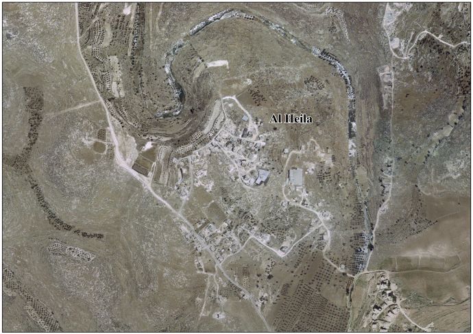
- Al-Heila (àrab: الحيلة, al-Ḥayla) és una vila palestina de la governació d'Hebron, a Cisjordània, situada 8 kilòmetres al sud d'Hebron. Segons l'Oficina Central Palestina d'Estadístiques tenia una població de 1.686 habitants el 2016. Les instal·lacions d'atenció primària de salut del poble són designades pel Ministeri de Salut com a nivell 1. (ca)
- الحيلة قرية فلسطينية من قرى محافظة الخليل في الضفة الغربية، تقع على بعد ثمانية كيلومترات جنوب مدينة الخليل. يوجد فيها عيادة صحية أولية من المستوى الأول تتبع وزارة الصحة الفلسطينية. تقع خدماتيًا ضمن مدينة يطا. (ar)
- al-Heila (Arabic: الحيلة) is a Palestinian village located eight kilometers south of Hebron. The village is in the Hebron Governorate Southern West Bank. According to the Palestinian Central Bureau of Statistics, the village had a population of 1,277 in 2007. The primary health care facilities for the village are designated by the Ministry of Health as level 1. (en)
|
| dbo:country
| |
| dbo:governmentType
| |
| dbo:populationTotal
|
- 1277 (xsd:nonNegativeInteger)
|
| dbo:subdivision
| |
| dbo:wikiPageExternalLink
| |
| dbo:wikiPageID
| |
| dbo:wikiPageLength
|
- 3793 (xsd:nonNegativeInteger)
|
| dbo:wikiPageRevisionID
| |
| dbo:wikiPageWikiLink
| |
| dbp:establishedTitle
| |
| dbp:governmentType
| |
| dbp:gridName
| |
| dbp:name
| |
| dbp:populationAsOf
| |
| dbp:populationDensityKm
| |
| dbp:populationTotal
| |
| dbp:pushpinMap
| |
| dbp:pushpinMapCaption
|
- Location of al-Heila within Palestine (en)
|
| dbp:subdivisionName
| |
| dbp:subdivisionType
| |
| dbp:translitLang
| |
| dbp:translitLang1Info
| |
| dbp:translitLang1Type
| |
| dbp:type
| |
| dbp:unitPref
| |
| dbp:wikiPageUsesTemplate
| |
| dct:subject
| |
| gold:hypernym
| |
| georss:point
|
- 31.473333333333333 35.10722222222222
|
| rdf:type
| |
| rdfs:comment
|
- Al-Heila (àrab: الحيلة, al-Ḥayla) és una vila palestina de la governació d'Hebron, a Cisjordània, situada 8 kilòmetres al sud d'Hebron. Segons l'Oficina Central Palestina d'Estadístiques tenia una població de 1.686 habitants el 2016. Les instal·lacions d'atenció primària de salut del poble són designades pel Ministeri de Salut com a nivell 1. (ca)
- الحيلة قرية فلسطينية من قرى محافظة الخليل في الضفة الغربية، تقع على بعد ثمانية كيلومترات جنوب مدينة الخليل. يوجد فيها عيادة صحية أولية من المستوى الأول تتبع وزارة الصحة الفلسطينية. تقع خدماتيًا ضمن مدينة يطا. (ar)
- al-Heila (Arabic: الحيلة) is a Palestinian village located eight kilometers south of Hebron. The village is in the Hebron Governorate Southern West Bank. According to the Palestinian Central Bureau of Statistics, the village had a population of 1,277 in 2007. The primary health care facilities for the village are designated by the Ministry of Health as level 1. (en)
|
| rdfs:label
|
- الحيلة (الخليل) (ar)
- Al-Heila (ca)
- Al-Heila (en)
|
| owl:sameAs
| |
| geo:geometry
|
- POINT(35.107223510742 31.473333358765)
|
| geo:lat
| |
| geo:long
| |
| prov:wasDerivedFrom
| |
| foaf:isPrimaryTopicOf
| |
| foaf:name
| |
| is dbo:wikiPageWikiLink
of | |
| is foaf:primaryTopic
of | |


