About: Campeche Bank Goto Sponge NotDistinct Permalink
An Entity of Type : yago:YagoPermanentlyLocatedEntity,
within Data Space : dbpedia.org associated with source document(s)

![http://dbpedia.org/describe/?url=http%3A%2F%2Fdbpedia.org%2Fresource%2FCampeche_Bank]()

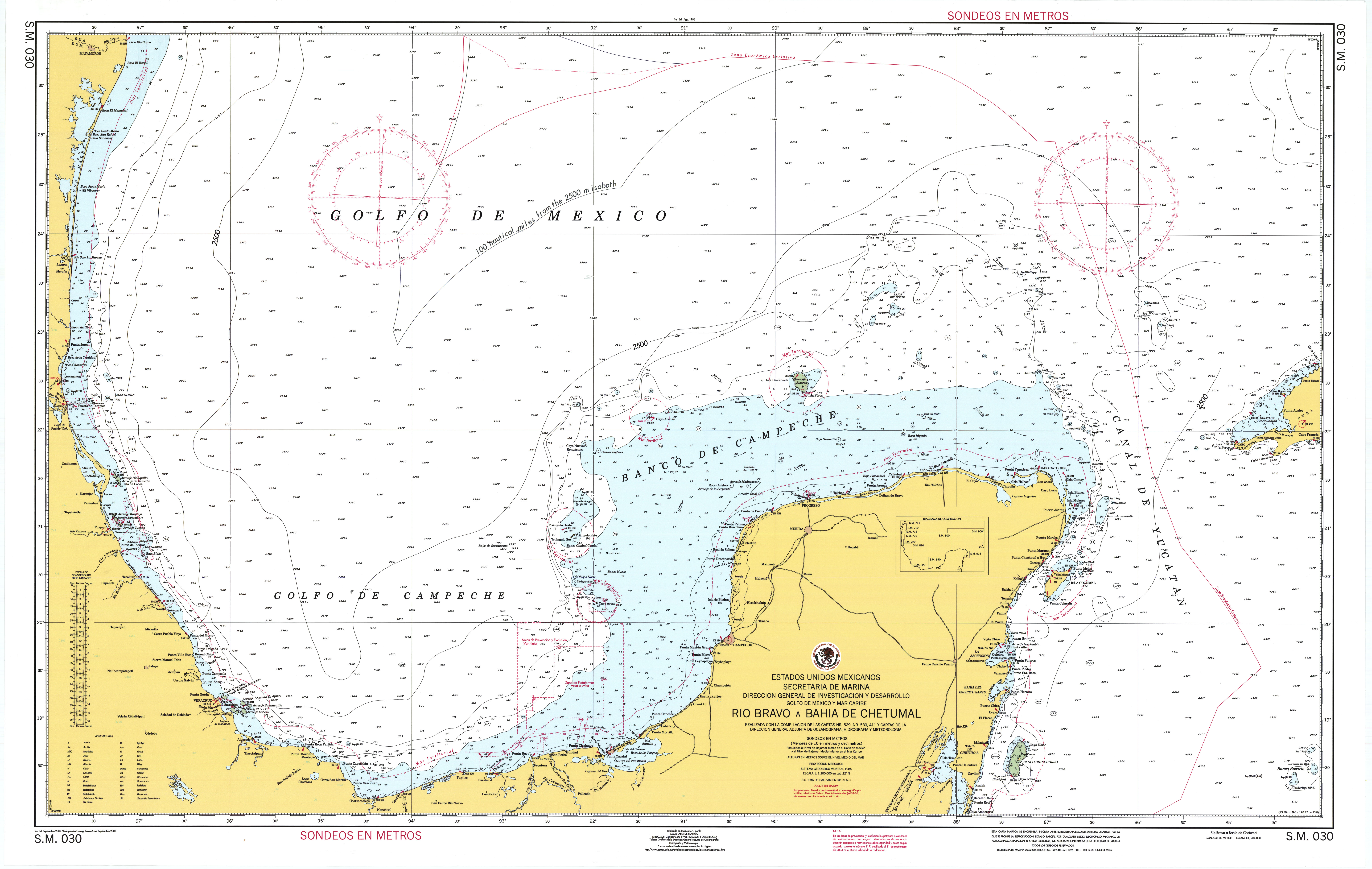
Campeche Bank is part of the Gulf of Mexico and extends from the Yucatan Straits in the east to the in the west. The Campeche ocean bank is 81 miles (130 km) from Mexico's geography of Campeche nautically bearing 100 nautical miles (120 mi; 190 km) south of the Tropic of Cancer. Campeche Bank is cast as cays and reefs with islets encompassing Arrecife Alacran and Sigsbee Deep to the north with a southwest island arc of the Cayos Arcas archipelago isolated 92 nautical miles (106 mi; 170 km) north of Ciudad del Carmen.
Faceted Search & Find service v1.17_git139 as of Feb 29 2024


![[RDF Data]](/fct/images/sw-rdf-blue.png)

OpenLink Virtuoso version 08.03.3330 as of Mar 19 2024, on Linux (x86_64-generic-linux-glibc212), Single-Server Edition (61 GB total memory, 48 GB memory in use)
Data on this page belongs to its respective rights holders.
Virtuoso Faceted Browser Copyright © 2009-2024 OpenLink Software


![[RDF Data]](/fct/images/sw-rdf-blue.png)
OpenLink Virtuoso version 08.03.3330 as of Mar 19 2024, on Linux (x86_64-generic-linux-glibc212), Single-Server Edition (61 GB total memory, 48 GB memory in use)
Data on this page belongs to its respective rights holders.
Virtuoso Faceted Browser Copyright © 2009-2024 OpenLink Software


![[cxml]](/fct/images/cxml_doc.png)
![[csv]](/fct/images/csv_doc.png)
![[text]](/fct/images/ntriples_doc.png)
![[turtle]](/fct/images/n3turtle_doc.png)
![[ld+json]](/fct/images/jsonld_doc.png)
![[rdf+json]](/fct/images/json_doc.png)
![[rdf+xml]](/fct/images/xml_doc.png)
![[atom+xml]](/fct/images/atom_doc.png)
![[html]](/fct/images/html_doc.png)